what does the shaded area on the map show?\no india after world war ii\no bangladesh after world war ii\no…
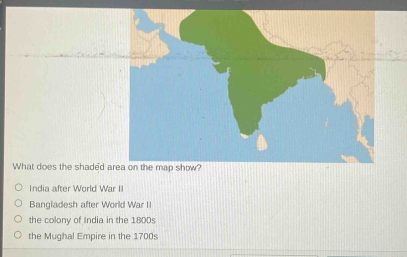
what does the shaded area on the map show?\no india after world war ii\no bangladesh after world war ii\no the colony of india in the 1800s\no the mughal empire in the 1700s
Answer
Brief Explanations:
The shaded area represents the general geographical extent of India during the colonial period in the 1800s. After World - War II, India and Bangladesh were partitioned, and the Mughal Empire in the 1700s had a different territorial configuration.
Answer:
the colony of India in the 1800s