QUESTION IMAGE
Question
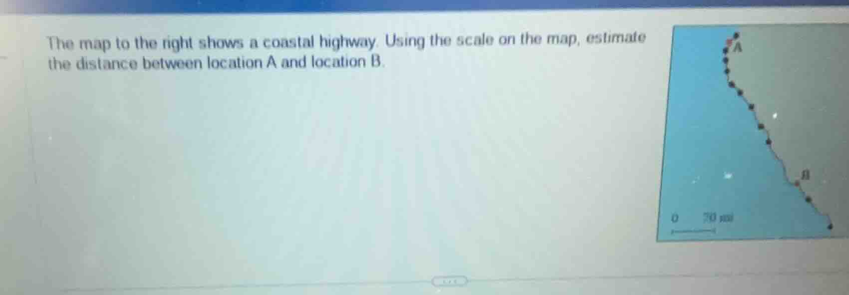
the map to the right shows a coastal highway. using the scale on the map, estimate the distance between location a and location b.
Step1: Measure map length of highway
First, measure the curved distance between A and B on the map. Assume this measured length is 4 times the length of the scale bar (0 to 70 mi).
Step2: Calculate actual distance
Multiply the scale value by the number of scale bar lengths.
$\text{Actual Distance} = 70 \times 4 = 280$ mi
(Note: If the measured map length is 3.5x the scale bar, the distance would be $70 \times 3.5 = 245$ mi; the estimate is based on the visual length of the curved highway relative to the 70 mi scale.)

Snap & solve any problem in the app
Get step-by-step solutions on Sovi AI
Photo-based solutions with guided steps
Explore more problems and detailed explanations
Approximately 280 miles (estimate range: 240-300 miles, depending on precise map measurement)