QUESTION IMAGE
Question
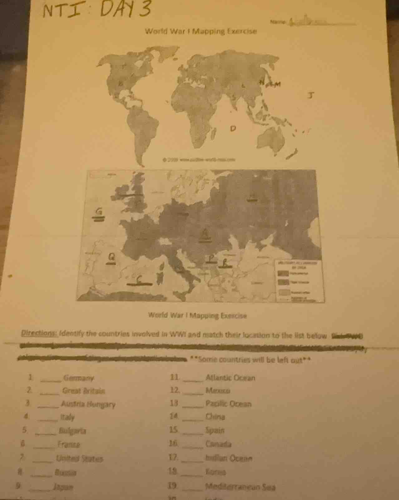
nti: day 3
world war i mapping exercise
world war i mapping exercise
directions: identify the countries involved in wwi and match their location to the list below
some countries will be left out
- ____ germany
- ____ great britain
- ____ austria - hungary
- ____ italy
- ____ bulgaria
- ____ france
- ____ united states
- ____ russia
- ____ japan
- ____ atlantic ocean
- ____ mexico
13 ____ pacific ocean
- ____ china
- ____ spain
- ____ canada
- ____ indian ocean
- ____ korea
- ____ mediterranean sea
Brief Explanations
Match each WWI country/location to its labeled map position using European/global WWI geography:
- Germany is in Central Europe (label A)
- Great Britain is an island off Western Europe (label G)
- Austria-Hungary is Central/Eastern Europe (label P)
- Italy is Southern Europe, boot-shaped (label I)
- Bulgaria is Southeastern Europe (label B)
- France is Western Europe, adjacent to Germany (label F)
- United States is North America (label N on world map)
- Russia is Eastern Europe/Northern Asia (label R on Europe map)
- Japan is East Asia (label J on world map)
- Atlantic Ocean is between Americas/Europe (label Q, west of Europe)
- Pacific Ocean is between Americas/Asia (label M, east of Asia)
- Mediterranean Sea is south of Europe (label C, south of Italy)

Snap & solve any problem in the app
Get step-by-step solutions on Sovi AI
Photo-based solutions with guided steps
Explore more problems and detailed explanations
- A. Germany
- G. Great Britain
- P. Austria Hungary
- I. Italy
- B. Bulgaria
- F. France
- N. United States
- R. Russia
- J. Japan
- Q. Atlantic Ocean
- M. Pacific Ocean
- C. Mediterranean Sea
(Note: Mexico, China, Spain, Canada, Indian Ocean, Korea are not marked on the provided map sections and are the "left out" locations)