QUESTION IMAGE
Question
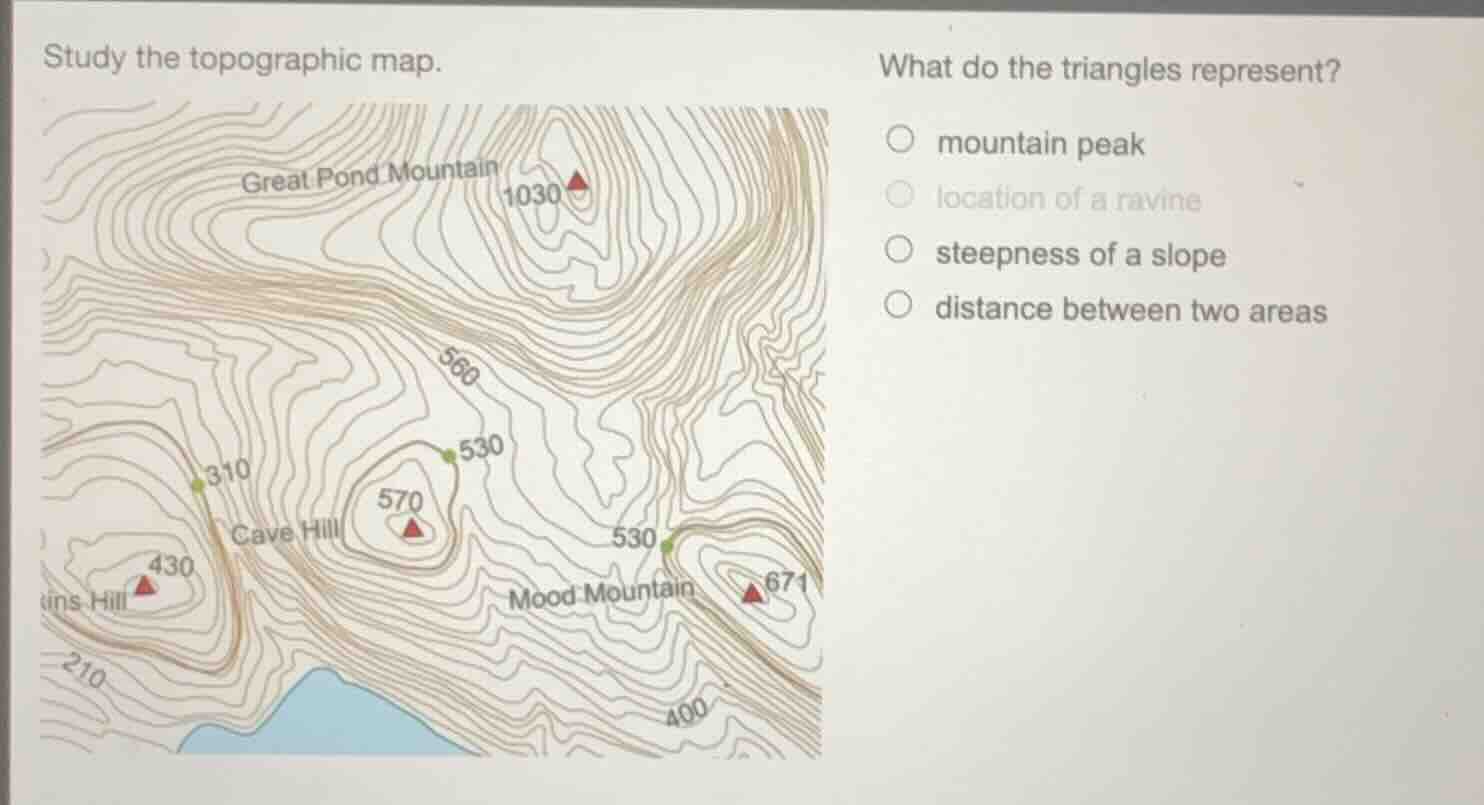
study the topographic map.
what do the triangles represent?
○ mountain peak
○ location of a ravine
○ steepness of a slope
○ distance between two areas
Brief Explanations
On topographic maps, triangular symbols paired with elevation values (like 1030, 570, 430, 671 here) are standard markers for the highest point of a landform, which is a mountain peak. Ravines are shown by V-shaped contour lines pointing uphill, slope steepness is indicated by contour line spacing, and distance is measured via map scale, not triangles.

Snap & solve any problem in the app
Get step-by-step solutions on Sovi AI
Photo-based solutions with guided steps
Explore more problems and detailed explanations
mountain peak