QUESTION IMAGE
Question
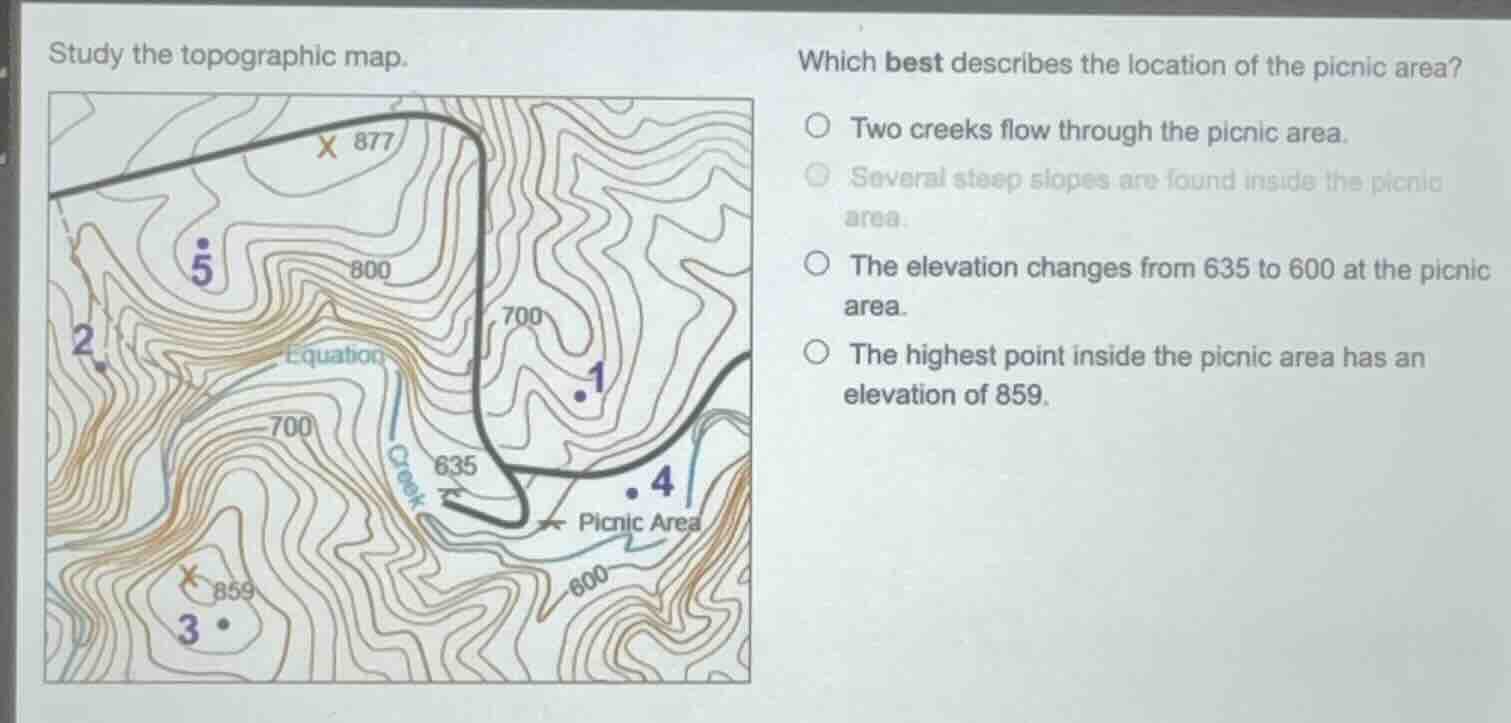
study the topographic map.
which best describes the location of the picnic area?
two creeks flow through the picnic area.
several steep slopes are found inside the picnic area.
the elevation changes from 635 to 600 at the picnic area.
the highest point inside the picnic area has an elevation of 859.
Brief Explanations
- Check the first option: Only one creek (labeled "Creek") runs along the edge of the picnic area, not two flowing through it. This is incorrect.
- Check the second option: The picnic area has widely spaced contour lines, which indicate gentle, not steep, slopes. This is incorrect.
- Check the third option: The picnic area is between the 600 and 635 contour lines, so elevation ranges from 600 to 635 (not 635 to 600, as elevation increases with higher contour numbers). This is incorrect.
- Check the fourth option: The marked point 859 is inside the picnic area's boundary, and it is the highest labeled/visible point within that area. This is correct.

Snap & solve any problem in the app
Get step-by-step solutions on Sovi AI
Photo-based solutions with guided steps
Explore more problems and detailed explanations
The highest point inside the picnic area has an elevation of 859.