QUESTION IMAGE
Question
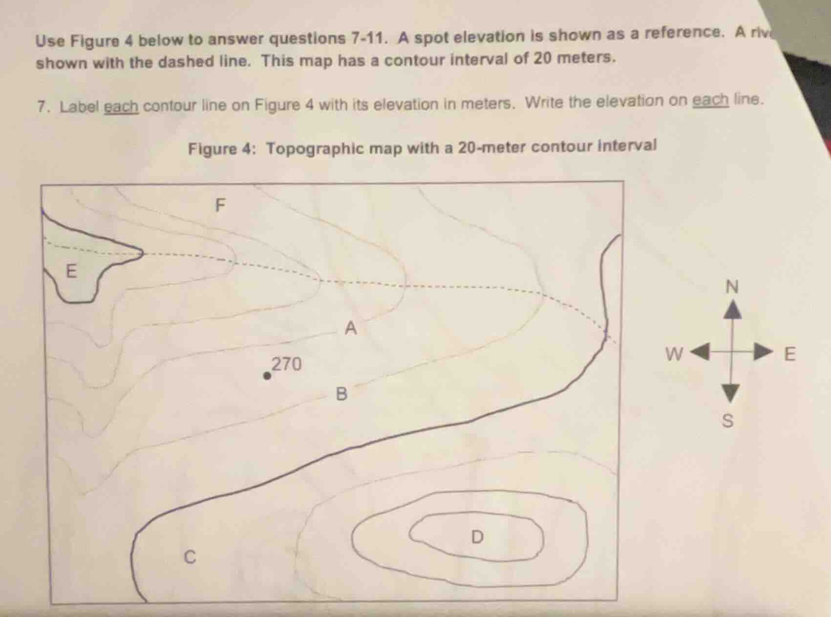
use figure 4 below to answer questions 7-11. a spot elevation is shown as a reference. a rive shown with the dashed line. this map has a contour interval of 20 meters.
- label each contour line on figure 4 with its elevation in meters. write the elevation on each line.
figure 4: topographic map with a 20-meter contour interval
Step1: Identify reference elevation
Spot elevation = 270 meters
Step2: Analyze contour interval
Contour interval = 20 meters
Step3: Label line B (next to spot)
Line B is at the same elevation as the spot: $270$ meters
Step4: Label line A (uphill from B)
Add 20m to B's elevation: $270 + 20 = 290$ meters
Step5: Label line F (uphill from A)
Add 20m to A's elevation: $290 + 20 = 310$ meters
Step6: Label line E (uphill from F)
Add 20m to F's elevation: $310 + 20 = 330$ meters
Step7: Label line C (downhill from B)
Subtract 20m from B's elevation: $270 - 20 = 250$ meters
Step8: Label outer D line (uphill from C)
Add 20m to C's elevation: $250 + 20 = 270$ meters
Step9: Label middle D line (uphill from outer D)
Add 20m to outer D: $270 + 20 = 290$ meters
Step10: Label inner D line (uphill from middle D)
Add 20m to middle D: $290 + 20 = 310$ meters

Snap & solve any problem in the app
Get step-by-step solutions on Sovi AI
Photo-based solutions with guided steps
Explore more problems and detailed explanations
- Line E: 330 meters
- Line F: 310 meters
- Line A: 290 meters
- Line B: 270 meters
- Line C: 250 meters
- Outer D line: 270 meters
- Middle D line: 290 meters
- Inner D line: 310 meters