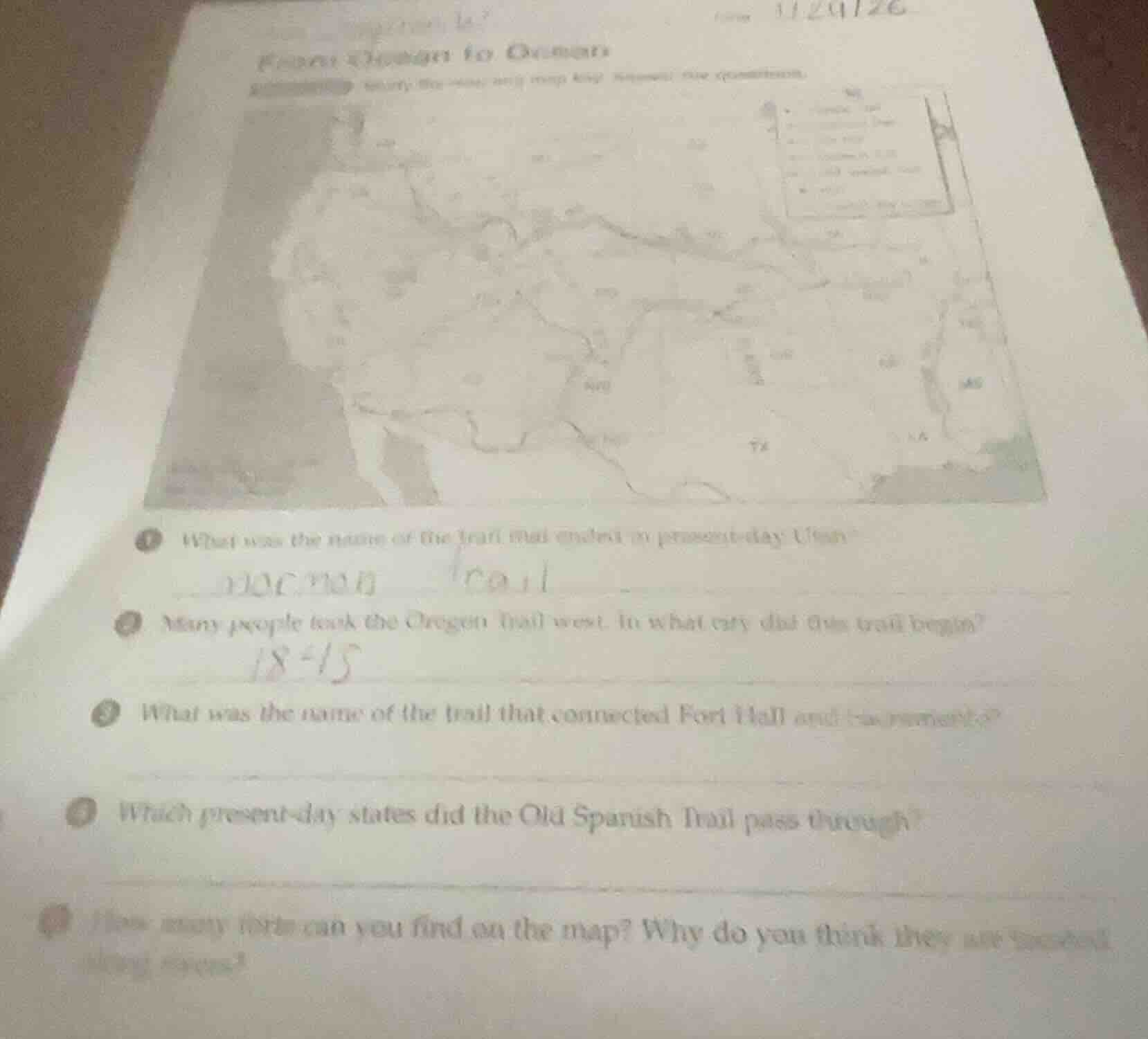
QUESTION IMAGE
Question
1 what was the name of the trail that ended in present - day utah?
2 many people took the oregon trail west. in what city did this trail begin?
3 what was the name of the trail that connected fort hall and sacramento?
4 which present - day states did the old spanish trail pass through?
5 how many forts can you find on the map? why do you think they are located along rivers?
Brief Explanations
- The trail ending in present-day Utah was used by Mormon settlers.
- The Oregon Trail's eastern starting point was a Missouri river city.
- The trail linking Fort Hall to Sacramento was a key California route.
- The Old Spanish Trail traversed southwestern US states.
- Forts on the map were placed near rivers for water access, critical for travelers and supplies.

Snap & solve any problem in the app
Get step-by-step solutions on Sovi AI
Photo-based solutions with guided steps
Explore more problems and detailed explanations
- Mormon Trail
- Independence (Missouri)
- California Trail
- New Mexico, Arizona, Utah, Nevada, and California
- (Note: Exact count depends on map details; typical count is 5-7 key forts.) Forts are located along rivers because water was essential for drinking, livestock, and travel rest stops for westward migrants.