QUESTION IMAGE
Question
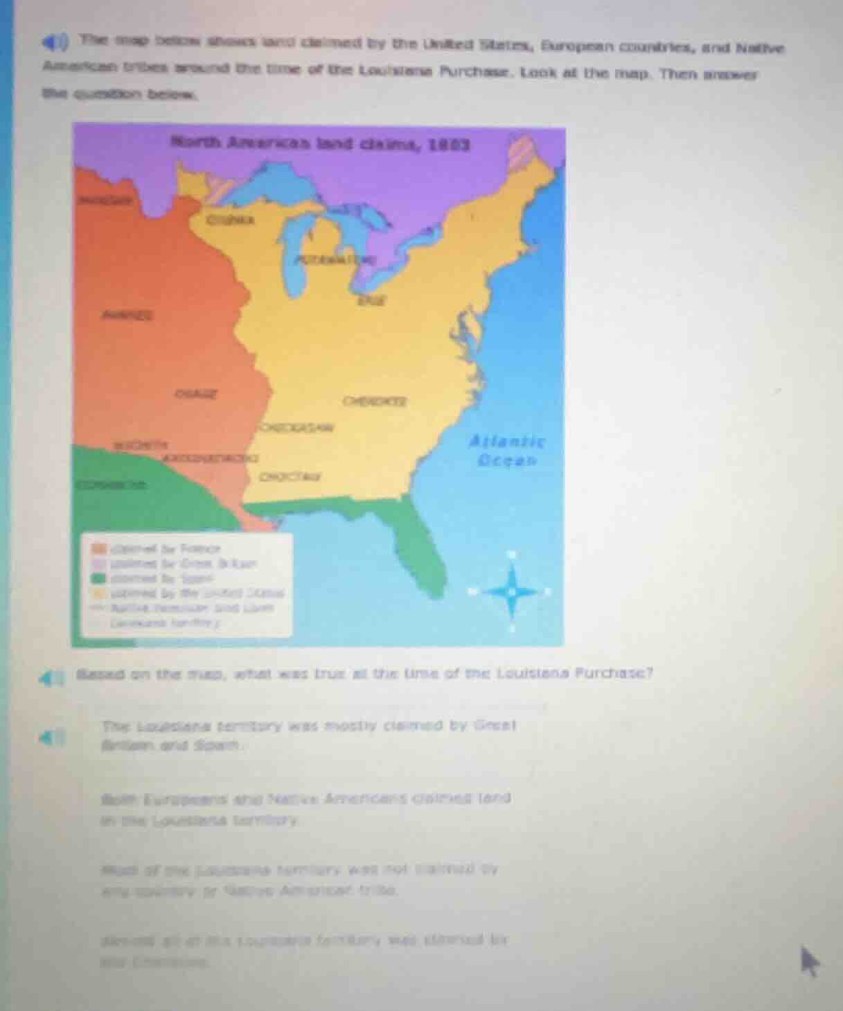
40 the map below shows land claimed by the united states, european countries, and native american tribes around the time of the louisiana purchase. look at the map. then answer the question below.
north american land claims, 1803
41 based on the map, what was true at the time of the louisiana purchase?
the louisiana territory was mostly claimed by great britain and spain.
both europeans and native americans claimed land in the louisiana territory.
most of the louisiana territory was not claimed by any country or native american tribe.
almost all of the louisiana territory was claimed by the cherokees.
The map shows the Louisiana Territory (the large orange area labeled "FRANCE") overlapping with multiple Native American lands (Osage, Pawnee, etc.) within its bounds. This means both European powers (France) and Native American nations claimed land in this territory. The other options are incorrect: the territory was mostly French-owned, not unclaimed, nor only claimed by Great Britain/Spain or just Europeans.

Snap & solve any problem in the app
Get step-by-step solutions on Sovi AI
Photo-based solutions with guided steps
Explore more problems and detailed explanations
Both Europeans and Native Americans claimed land in the Louisiana territory.