QUESTION IMAGE
Question
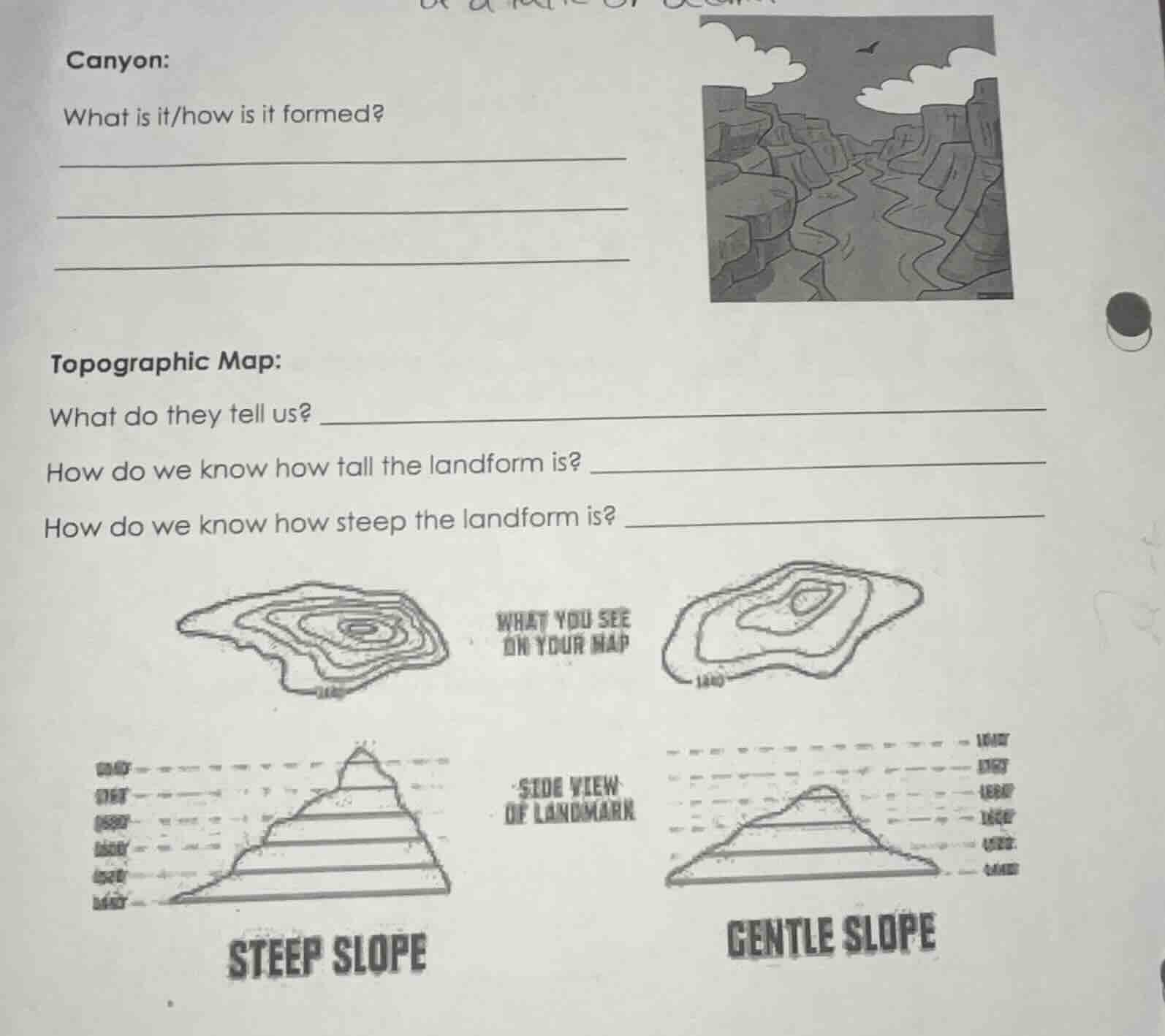
canyon:
what is it/how is it formed?
_______________________________
_______________________________
_______________________________
topographic map:
what do they tell us? _______________________________
how do we know how tall the landform is? _______________________________
how do we know how steep the landform is? _______________________________
Brief Explanations
- For canyons: A canyon is a deep, narrow valley with steep rock walls. It forms over millions of years when a river erodes (wears away) the rock and soil through continuous flowing water, cutting deeper and wider over time.
- For topographic maps:
- They show the 3D shape of the land, including elevation, hills, valleys, and other landforms, using contour lines.
- Elevation (height of the landform) is determined by reading the labeled contour lines, which mark specific vertical heights above sea level.
- Slope steepness is shown by how close contour lines are: closely spaced lines mean a steep slope, while widely spaced lines mean a gentle slope.

Snap & solve any problem in the app
Get step-by-step solutions on Sovi AI
Photo-based solutions with guided steps
Explore more problems and detailed explanations
- Canyon: A canyon is a deep, narrow valley with steep rock walls. It forms when a river continuously erodes rock/soil over millions of years, carving the land deeper and wider over time.
- Topographic Map:
- What do they tell us? They show the 3-dimensional shape of the land, including elevation, hills, valleys, and other landforms.
- How do we know how tall the landform is? We read the labeled contour lines that mark specific elevations above sea level, then calculate the difference between the highest and lowest relevant lines.
- How do we know how steep the landform is? Closely spaced contour lines indicate a steep slope; widely spaced contour lines indicate a gentle slope.