QUESTION IMAGE
Question
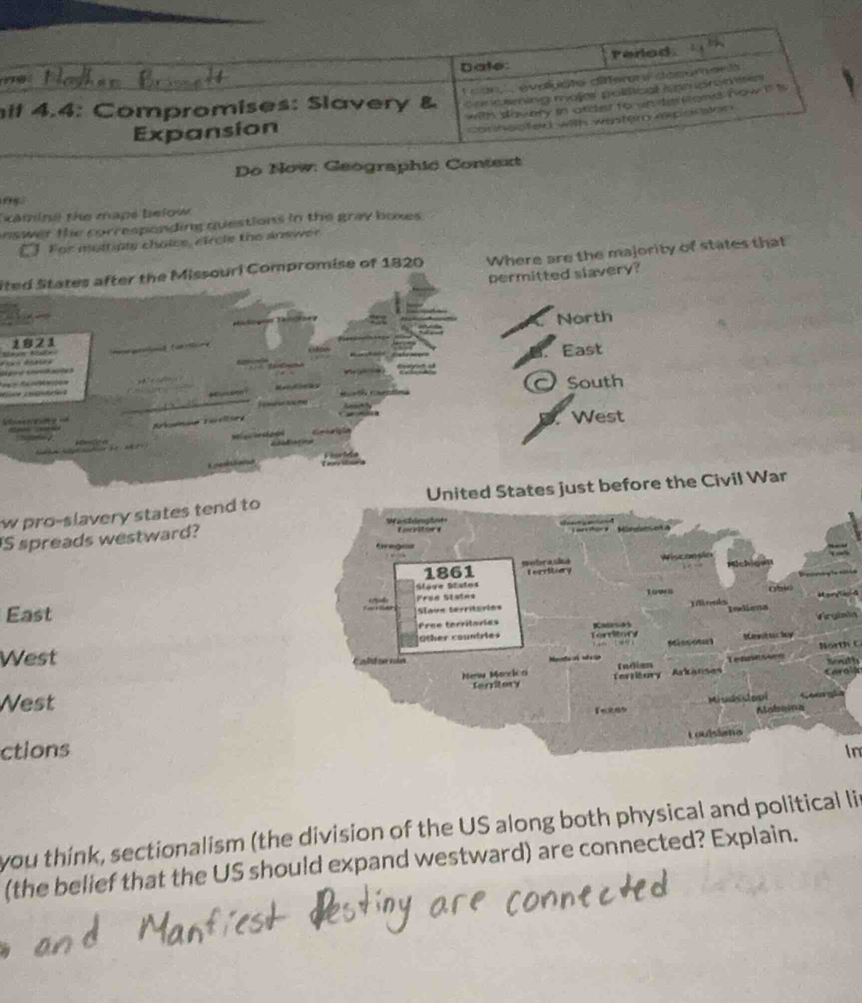
ill 4.4: compromises: slavery & expansion do now: geographic context ame: xamine the map below nswer the corresponding questions in the gray boxes. for multiple choices, circle the answer. ted states after the missouri compromise of 1820 where are the majority of states that permitted slavery? north east south west w pro - slavery states tend to s spreads westward? east west west ctions united states just before the civil war you think, sectionalism (the division of the us along both physical and political li (the belief that the us should expand westward) are connected? explain. and manifest destiny are connected
- For the first question: Based on U.S. historical geography of slavery, the majority of states allowing slavery were located in the South, as seen in the 1820 Missouri Compromise map.
- For the second question: As the U.S. expanded westward, pro-slavery states extended into the southern western regions, matching the 1861 pre-Civil War map.
- For the connection question: Manifest Destiny drove westward expansion, which forced debates over whether new territories would allow slavery. This deepened the divide between pro-slavery Southern and anti-slavery Northern regions, fueling sectionalism as each side fought to maintain political power in Congress by controlling new states' slavery status.

Snap & solve any problem in the app
Get step-by-step solutions on Sovi AI
Photo-based solutions with guided steps
Explore more problems and detailed explanations
- C. South
- South West
- Manifest Destiny and sectionalism are deeply connected: Westward expansion (driven by Manifest Destiny) created conflicts over whether new territories would permit slavery. This split the nation along regional lines—Southern states pushed for slavery expansion to preserve political power, while Northern states opposed it, worsening sectional divides that ultimately led to the Civil War.