QUESTION IMAGE
Question
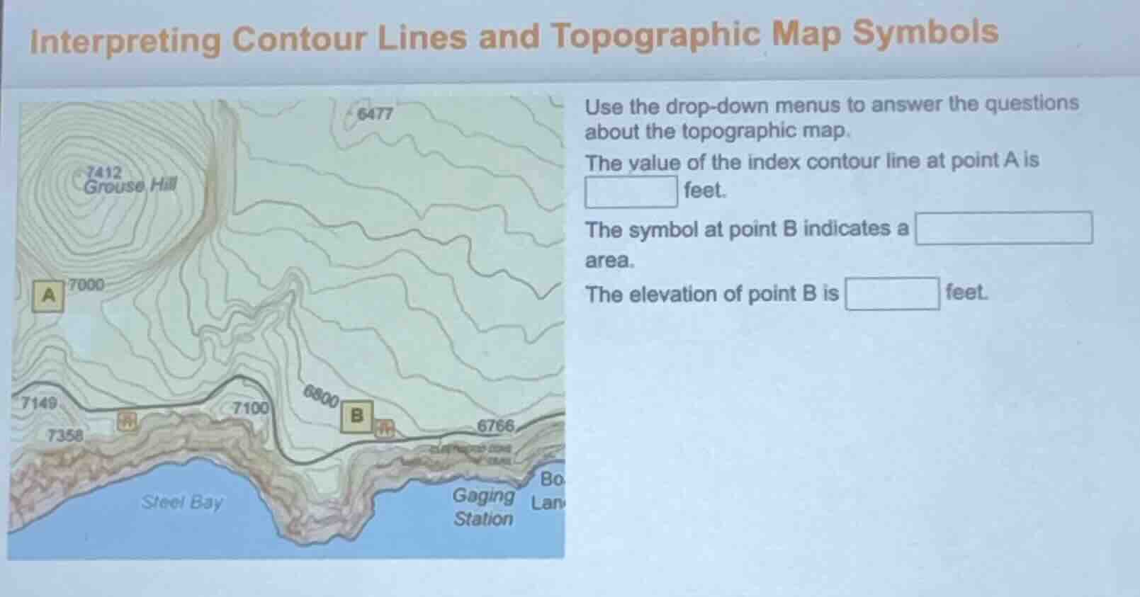
interpreting contour lines and topographic map symbols
use the drop - down menus to answer the questions about the topographic map.
the value of the index contour line at point a is
feet.
the symbol at point b indicates a
area.
the elevation of point b is
feet.
Step1: Identify index contour at A
Point A is directly on the labeled contour line marked 7000.
Step2: Identify symbol at B
The symbol at B is a standard topographic map symbol for marsh/wetland.
Step3: Find elevation of B
Point B lies on the labeled contour line marked 6800.

Snap & solve any problem in the app
Get step-by-step solutions on Sovi AI
Photo-based solutions with guided steps
Explore more problems and detailed explanations
The value of the index contour line at point A is 7000 feet.
The symbol at point B indicates a wetland/marsh area.
The elevation of point B is 6800 feet.