QUESTION IMAGE
Question
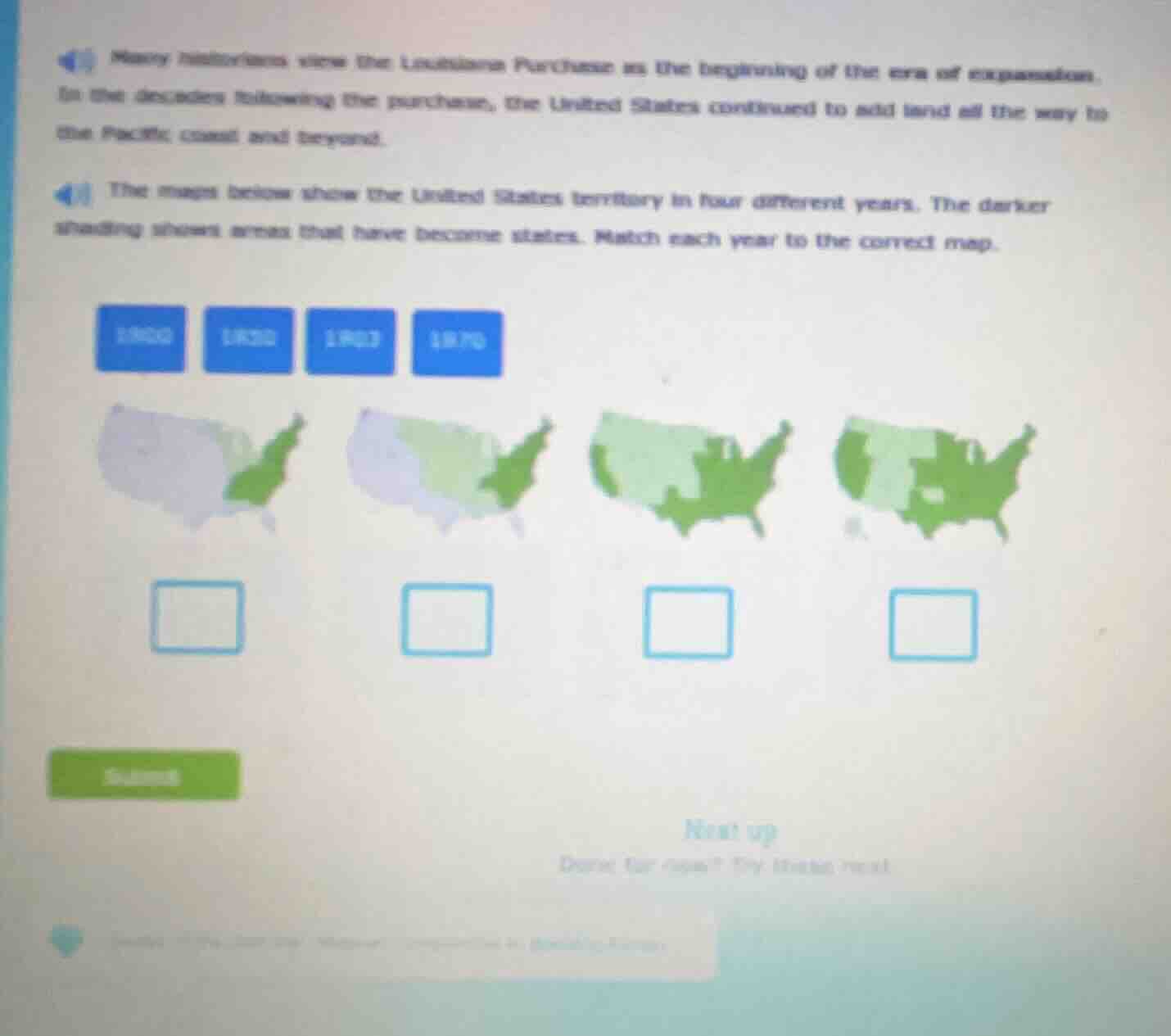
many historians view the louisiana purchase as the beginning of the era of expansion. in the decades following the purchase, the united states continued to add land all the way to the pacific coast and beyond. the maps below show the united states territory in four different years. the darker shading shows areas that have become states. match each year to the correct map. 1800 1820 1845 1870
Brief Explanations
- 1800: Pre-Louisiana Purchase, only original eastern states are states. This matches the first map (smallest dark green area, only the original 13 states region).
- 1820: Post-Louisiana Purchase (1803), but before major western expansion like Texas annexation or Oregon Territory. This matches the second map (dark green eastern states, light green Louisiana Territory added but not yet states).
- 1863: During the Civil War; Texas, parts of the Midwest, and Southeast are states, with western territories still unorganized. This matches the third map (expanded dark green to include Texas, Midwest, more of the South).
- 1870: Post-Civil War, with more western states admitted (like Kansas, Nevada) and expanded statehood across the continent. This matches the fourth map (largest dark green area, most of the contiguous US as states).

Snap & solve any problem in the app
Get step-by-step solutions on Sovi AI
Photo-based solutions with guided steps
Explore more problems and detailed explanations
First map (leftmost): 1800
Second map: 1820
Third map: 1863
Fourth map (rightmost): 1870