QUESTION IMAGE
Question
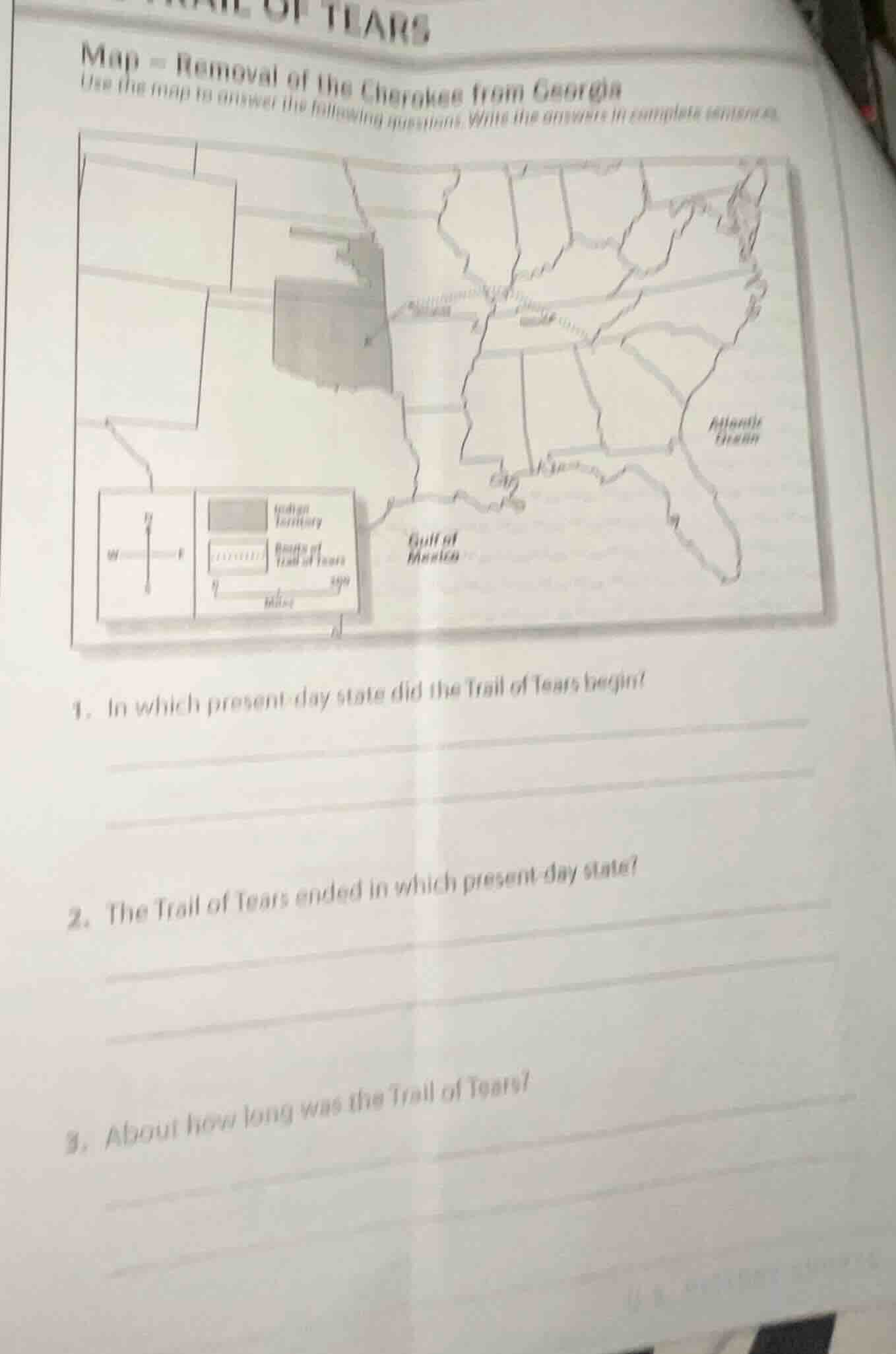
map - removal of the cherokee from georgia
use the map to answer the following questions. write the answers in complete sentences.
- in which present - day state did the trail of tears begin?
- the trail of tears ended in which present - day state?
- about how long was the trail of tears?
1.
The Trail of Tears was the forced relocation of the Cherokee Nation. The map's title mentions "Removal of the Cherokee from Georgia", and Georgia is the present - day state where the Trail of Tears began for the Cherokee.
The Trail of Tears ended in the present - day state of Oklahoma. The Cherokee were relocated to the Indian Territory, which is now Oklahoma.
Looking at the map's scale (which is 0 - 500 miles) and the path of the Trail of Tears, we can estimate the length. The Trail of Tears was about 1,000 miles long (this is an approximate value based on the map's scale and the typical length of the Trail of Tears route).

Snap & solve any problem in the app
Get step-by-step solutions on Sovi AI
Photo-based solutions with guided steps
Explore more problems and detailed explanations
The Trail of Tears began in the present - day state of Georgia.