QUESTION IMAGE
Question
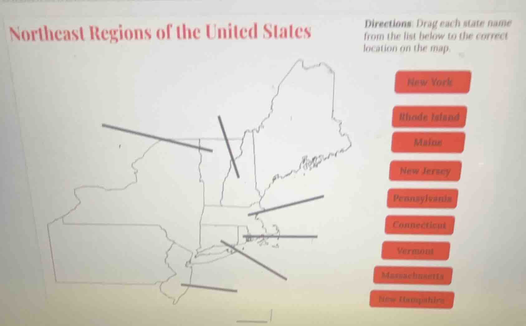
northeast regions of the united states
directions: drag each state name from the list below to the correct location on the map.
new york
rhode island
maine
new jersey
pennsylvania
connecticut
vermont
massachusetts
new hampshire
Brief Explanations
Match each state to its geographic outline in the US Northeast region, based on standard US state map boundaries:
- The largest western state is New York.
- The state south of New York is Pennsylvania.
- The southernmost small state is New Jersey.
- The northernmost state is Maine.
- The state southwest of Maine is New Hampshire.
- The state west of New Hampshire is Vermont.
- The large coastal state south of New Hampshire is Massachusetts.
- The small state south of Massachusetts is Rhode Island.
- The state southwest of Rhode Island is Connecticut.

Snap & solve any problem in the app
Get step-by-step solutions on Sovi AI
Photo-based solutions with guided steps
Explore more problems and detailed explanations
- Westernmost large outline: New York
- Outline south of New York: Pennsylvania
- Southernmost small outline: New Jersey
- Northernmost outline: Maine
- Outline southwest of Maine: New Hampshire
- Outline west of New Hampshire: Vermont
- Large coastal outline south of New Hampshire: Massachusetts
- Small outline south of Massachusetts: Rhode Island
- Outline southwest of Rhode Island: Connecticut