QUESTION IMAGE
Question
passage one
passage two
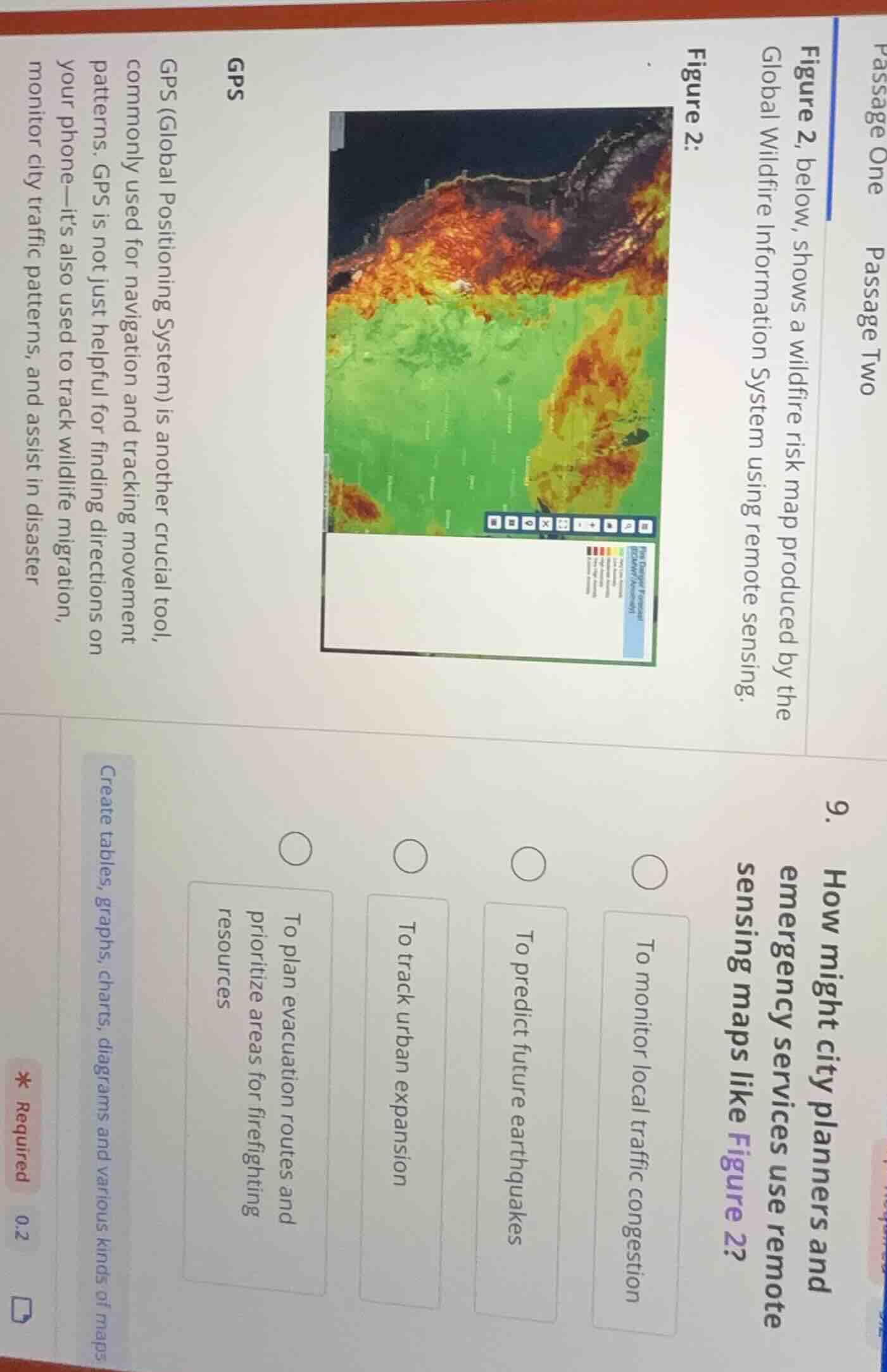
figure 2, below, shows a wildfire risk map produced by the global wildfire information system using remote sensing.
figure 2:
gps
gps (global positioning system) is another crucial tool, commonly used for navigation and tracking movement patterns. gps is not just helpful for finding directions on your phone—it’s also used to track wildlife migration, monitor city traffic patterns, and assist in disaster
- how might city planners and emergency services use remote sensing maps like figure 2?
to monitor local traffic congestion
to predict future earthquakes
to track urban expansion
to plan evacuation routes and prioritize areas for firefighting resources
- required
create tables, graphs, charts, diagrams and various kinds of maps
Figure 2 is a wildfire risk map from remote sensing. City planners and emergency services would use this type of map to address wildfire-related preparedness and response. The other options do not relate to wildfire risk data: traffic congestion, urban expansion, and earthquake prediction are unrelated to this wildfire map's purpose.

Snap & solve any problem in the app
Get step-by-step solutions on Sovi AI
Photo-based solutions with guided steps
Explore more problems and detailed explanations
To plan evacuation routes and prioritize areas for firefighting resources