QUESTION IMAGE
Question
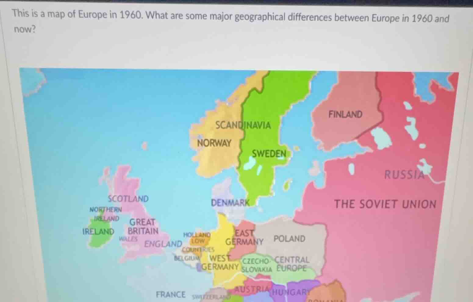
this is a map of europe in 1960. what are some major geographical differences between europe in 1960 and now?
Brief Explanations
- Political Geography (Country Boundaries): In 1960, there was East and West Germany (divided), the Soviet Union (a single large state), and countries like Czechoslovakia (not split). Now, Germany is unified, the Soviet Union has dissolved into multiple countries (e.g., Russia, Ukraine, Belarus, etc.), Czechoslovakia split into the Czech Republic and Slovakia.
- Country Naming/Existence: “Holland” (a region, now the Netherlands is the official country name), “Scandinavia” as a labeled region (now we refer to Norway, Sweden, Denmark, etc. as individual countries with clearer boundaries). Also, the UK's relationship with the EU (though 1960 is pre - EU major integration, now the UK has left the EU, but geographically, the main change is political boundaries of states.
- Balkan and Eastern Europe: In 1960, Yugoslavia existed (now split into multiple countries), and the Eastern Bloc had more unified - looking boundaries (now, with the fall of communism, countries like Poland, Hungary, etc. have different political and thus mapped boundaries in terms of alliances, but geographically, the state boundaries changed with the split of larger entities like the Soviet Union and Yugoslavia).

Snap & solve any problem in the app
Get step-by-step solutions on Sovi AI
Photo-based solutions with guided steps
Explore more problems and detailed explanations
- Germany: In 1960, divided into East Germany and West Germany; now unified as one Germany.
- Soviet Union: In 1960, existed as a single large country; now dissolved into multiple independent states (e.g., Russia, Ukraine, Belarus, etc.).
- Czechoslovakia: In 1960, was one country; now split into the Czech Republic and Slovakia.
- Yugoslavia: In 1960, existed; now split into several countries (e.g., Serbia, Croatia, Bosnia and Herzegovina, etc.).
- Country Naming/Region Labeling: “Holland” was labeled (now the country is officially the Netherlands), and “Scandinavia” was a broader labeled region (now individual countries like Norway, Sweden, Denmark have more distinct mappings).