QUESTION IMAGE
Question
multiple-choice question
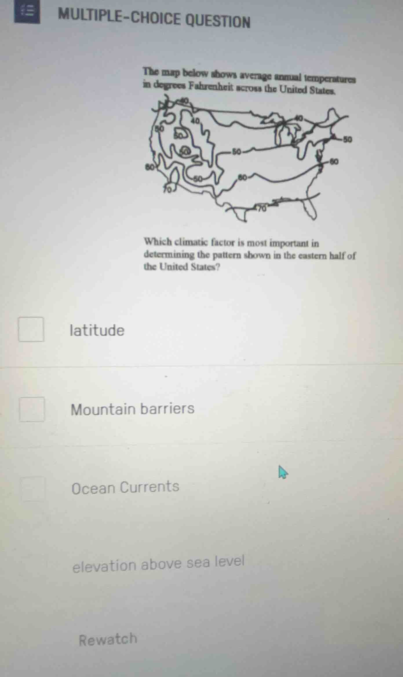
the map below shows average annual temperatures in degrees fahrenheit across the united states.
map of the us with temperature contour lines
which climatic factor is most important in determining the pattern shown in the eastern half of the united states?
- latitude
- mountain barriers
- ocean currents
- elevation above sea level
- rewatch
In the eastern half of the US, temperature patterns (warmer at lower latitudes, cooler at higher latitudes) align with latitude's effect (solar angle variation). Mountain barriers (e.g., Appalachians) are less impactful on broad east - west temp trends here. Ocean currents have more localized coastal effects, and elevation variation is minimal in the eastern lowlands. So latitude is the key factor.

Snap & solve any problem in the app
Get step-by-step solutions on Sovi AI
Photo-based solutions with guided steps
Explore more problems and detailed explanations
A. latitude