QUESTION IMAGE
Question
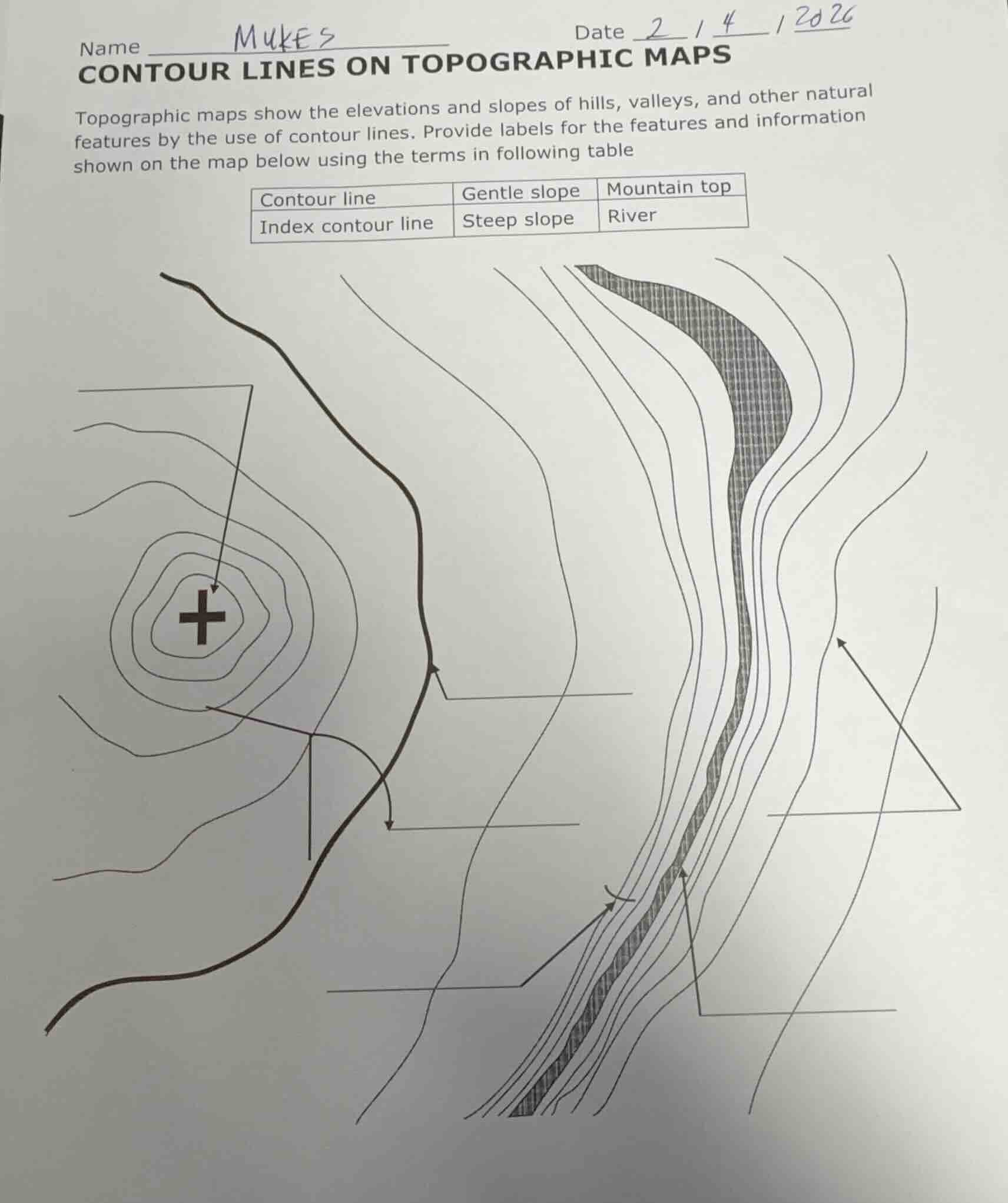
name mukesdate 2 / 4 / 2026contour lines on topographic mapstopographic maps show the elevations and slopes of hills, valleys, and other natural features by the use of contour lines. provide labels for the features and information shown on the map below using the terms in following tablecontour line | gentle slope | mountain topindex contour line | steep slope | river
Brief Explanations
- The cross at the center of concentric contour lines marks the highest point, so this is the mountain top.
- The thick, dark curved line represents a flowing water feature, so this is the river.
- The thick, bold contour line among thinner ones is an index contour line, used to reference elevation.
- The widely spaced contour lines indicate a gradual change in elevation, so this is a gentle slope.
- The closely packed contour lines show a rapid change in elevation, so this is a steep slope.
- The thin, regular lines connecting points of equal elevation are standard contour lines.

Snap & solve any problem in the app
Get step-by-step solutions on Sovi AI
Photo-based solutions with guided steps
Explore more problems and detailed explanations
- Arrow pointing to the cross: Mountain top
- Arrow pointing to the thick dark curved line: River
- Arrow pointing to the thick bold contour line: Index contour line
- Arrow pointing to widely spaced contour lines: Gentle slope
- Arrow pointing to closely packed contour lines: Steep slope
- Arrow pointing to thin regular contour lines: Contour line