QUESTION IMAGE
Question
passage one
passage two
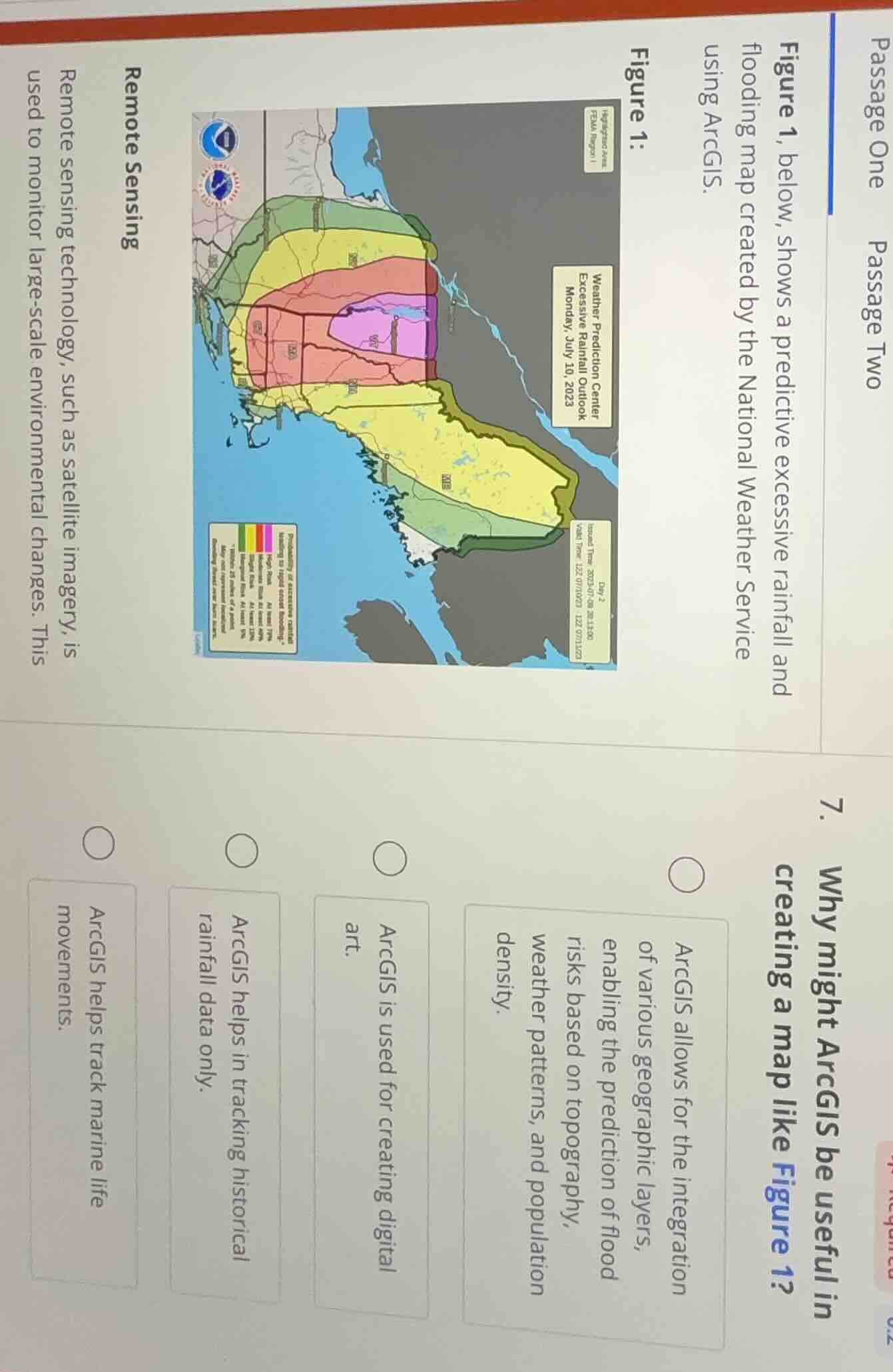
figure 1, below, shows a predictive excessive rainfall and flooding map created by the national weather service using arcgis.
figure 1:
remote sensing
remote sensing technology, such as satellite imagery, is used to monitor large - scale environmental changes. this
- why might arcgis be useful in creating a map like figure 1?
- arcgis allows for the integration of various geographic layers, enabling the prediction of flood risks based on topography, weather patterns, and population density.
- arcgis is used for creating digital art.
- arcgis helps in tracking historical rainfall data only.
- arcgis helps track marine life movements.
ArcGIS is a geographic information system that integrates spatial data like topography, weather patterns, and population density to model and predict flood risks, which is the core purpose of the predictive flooding map shown. The other options are incorrect: it is not primarily for digital art, it can integrate more than just historical rainfall data, and tracking marine life movements is not relevant to this flood map use case.

Snap & solve any problem in the app
Get step-by-step solutions on Sovi AI
Photo-based solutions with guided steps
Explore more problems and detailed explanations
ArcGIS allows for the integration of various geographic layers, enabling the prediction of flood risks based on topography, weather patterns, and population density.