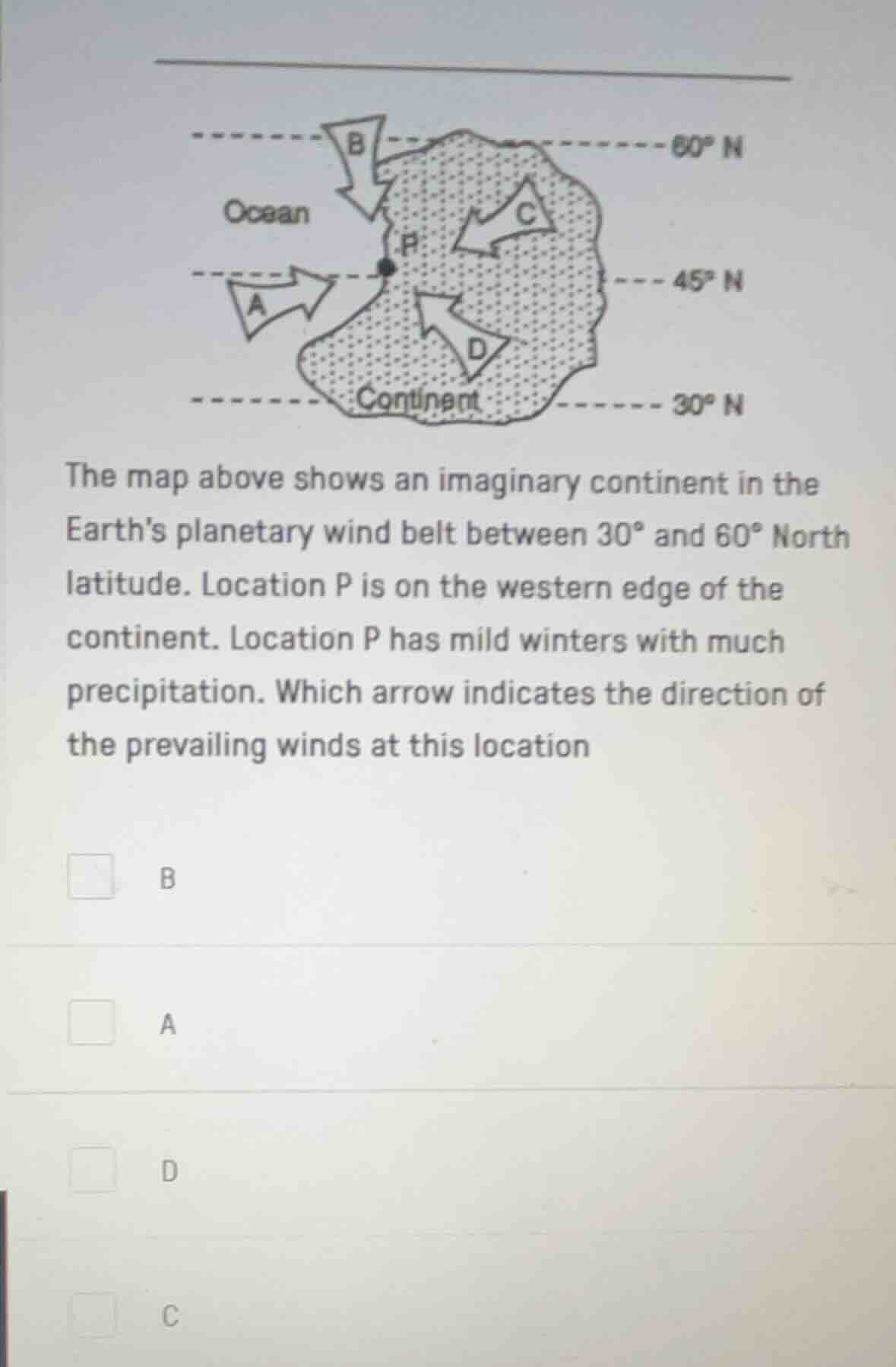
QUESTION IMAGE
Question
the map above shows an imaginary continent in the earths planetary wind belt between 30° and 60° north latitude. location p is on the western edge of the continent. location p has mild winters with much precipitation. which arrow indicates the direction of the prevailing winds at this location
options: b, a, d, c
Brief Explanations
- First, recall the wind belt between \(30^\circ\) and \(60^\circ\) N latitude: this is the westerlies wind belt in the Northern Hemisphere.
- The westerlies blow from the southwest to the northeast (or generally from the west - southwest direction towards the east - northeast). But for a location on the western edge of a continent between \(30^\circ\) and \(60^\circ\) N (like location P), the prevailing winds should come from the ocean (to bring moisture for precipitation) and follow the westerlies' general direction.
- Arrow A is coming from the ocean (west - southwest direction, consistent with westerlies in the Northern Hemisphere for a western continental edge), which would bring moist air from the ocean to location P, causing mild winters with much precipitation. Arrow B is from the north (too cold and dry), arrow C is from the continent (dry), and arrow D is from the south (not the direction of westerlies here).

Snap & solve any problem in the app
Get step-by-step solutions on Sovi AI
Photo-based solutions with guided steps
Explore more problems and detailed explanations
A. Arrow A