QUESTION IMAGE
Question
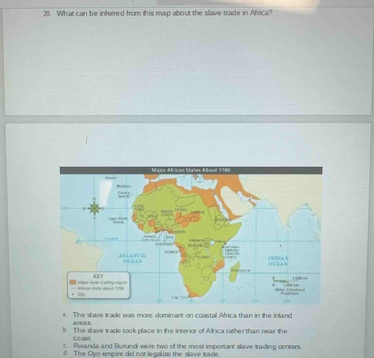
- what can be inferred from this map about the slave trade in africa?
major african states about 1700
key
major slave trading region
african state about 1700
city
a. the slave trade was more dominant on coastal africa than in the inland areas.
b. the slave trade took place in the interior of africa rather than near the coast
c. rwanda and burundi were two of the most important slave trading centers.
d. the oyo empire did not legalize the slave trade.
Looking at the map, the major slave trading regions (marked in orange) are concentrated along Africa's coasts, while the inland green areas (African states) have far fewer marked slave trading zones. Option b is directly contradicted by the map. Option c is incorrect because Rwanda and Burundi are not marked as major slave trading centers. Option d is wrong because the Oyo empire is near a major slave trading region, with no indication it banned the trade. Only option a matches the map's evidence.

Snap & solve any problem in the app
Get step-by-step solutions on Sovi AI
Photo-based solutions with guided steps
Explore more problems and detailed explanations
a. The slave trade was more dominant on coastal Africa than in the inland areas.