QUESTION IMAGE
Question
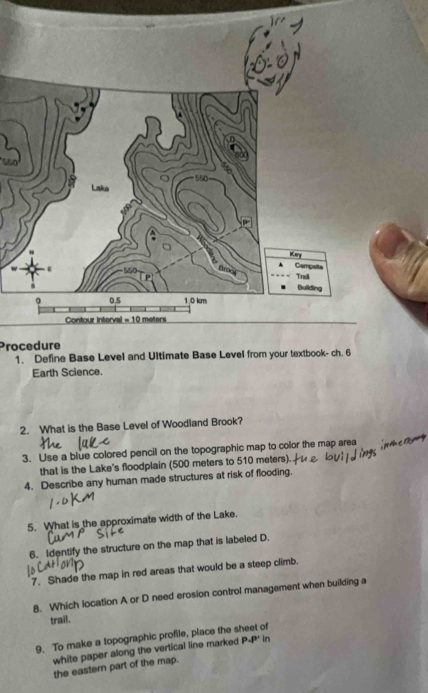
contour interval = 10 meters
procedure
- define base level and ultimate base level from your textbook- ch. 6 earth science.
- what is the base level of woodland brook?
- use a blue colored pencil on the topographic map to color the map area that is the lakes floodplain (500 meters to 510 meters).
- describe any human made structures at risk of flooding.
- what is the approximate width of the lake.
- identify the structure on the map that is labeled d.
- shade the map in red areas that would be a steep climb.
- which location a or d need erosion control management when building a trail.
- to make a topographic profile, place the sheet of white paper along the vertical line marked p-p in the eastern part of the map.

Snap & solve any problem in the app
Get step-by-step solutions on Sovi AI
Photo-based solutions with guided steps
Explore more problems and detailed explanations
The lake
The buildings near the lake (northwest area)
0.8 km (approximate)
D. Campsite
Location A