QUESTION IMAGE
Question
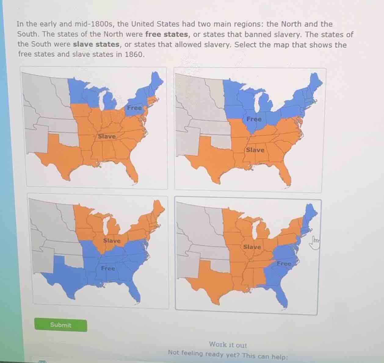
in the early and mid-1800s, the united states had two main regions: the north and the south. the states of the north were free states, or states that banned slavery. the states of the south were slave states, or states that allowed slavery. select the map that shows the free states and slave states in 1860.
In 1860, free states were all the northern U.S. states (northeast and upper Midwest) that banned slavery, while slave states were the southern states (southeast and lower Midwest) that allowed slavery. The correct map has blue (free) covering the Northeast and upper Midwest, and orange (slave) covering the South and border lower Midwest states, with western territories as unorganized gray areas.

Snap & solve any problem in the app
Get step-by-step solutions on Sovi AI
Photo-based solutions with guided steps
Explore more problems and detailed explanations
The top-right map (second map in the grid, with blue free states in the Northeast and upper Midwest, orange slave states in the South, and gray unorganized western territories)