QUESTION IMAGE
Question
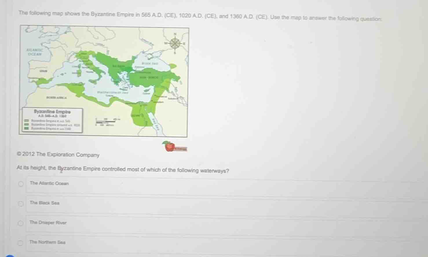
the following map shows the byzantine empire in 565 a.d. (ce), 1020 a.d. (ce), and 1360 a.d. (ce). use the map to answer the following question:© 2012 the exploration companyat its height, the byzantine empire controlled most of which of the following waterways?the atlantic oceanthe black seathe danube riverthe northern sea
Looking at the map's darkest green (Byzantine Empire at its height, 565 A.D.), the empire surrounds nearly all of the Black Sea's coastline, while it only has small access to the Atlantic, no control of the Dnieper River's full extent, and the "Northern Sea" is not a relevant major waterway for its peak territory.

Snap & solve any problem in the app
Get step-by-step solutions on Sovi AI
Photo-based solutions with guided steps
Explore more problems and detailed explanations
B. The Black Sea