QUESTION IMAGE
Question
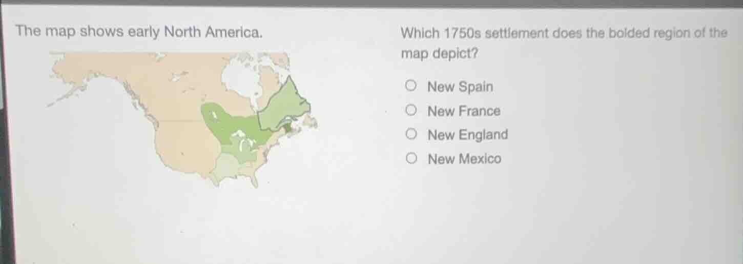
the map shows early north america. which 1750s settlement does the bolded region of the map depict? new spain new france new england new mexico
Brief Explanations
To determine the 1750s settlement of the bolded region, we analyze the options:
- New Spain: Covered southwestern and southern North America, not the bolded northeastern coastal area.
- New France: Included large parts of Canada and the Mississippi Valley, but the bolded region is smaller and coastal.
- New England: In the 1750s, New England was a British colonial region in the northeastern coastal area (present - day states like Massachusetts, Connecticut, etc.), matching the bolded region's location.
- New Mexico: Was in the southwestern part, not the northeastern coastal area.

Snap & solve any problem in the app
Get step-by-step solutions on Sovi AI
Photo-based solutions with guided steps
Explore more problems and detailed explanations
C. New England