QUESTION IMAGE
Question
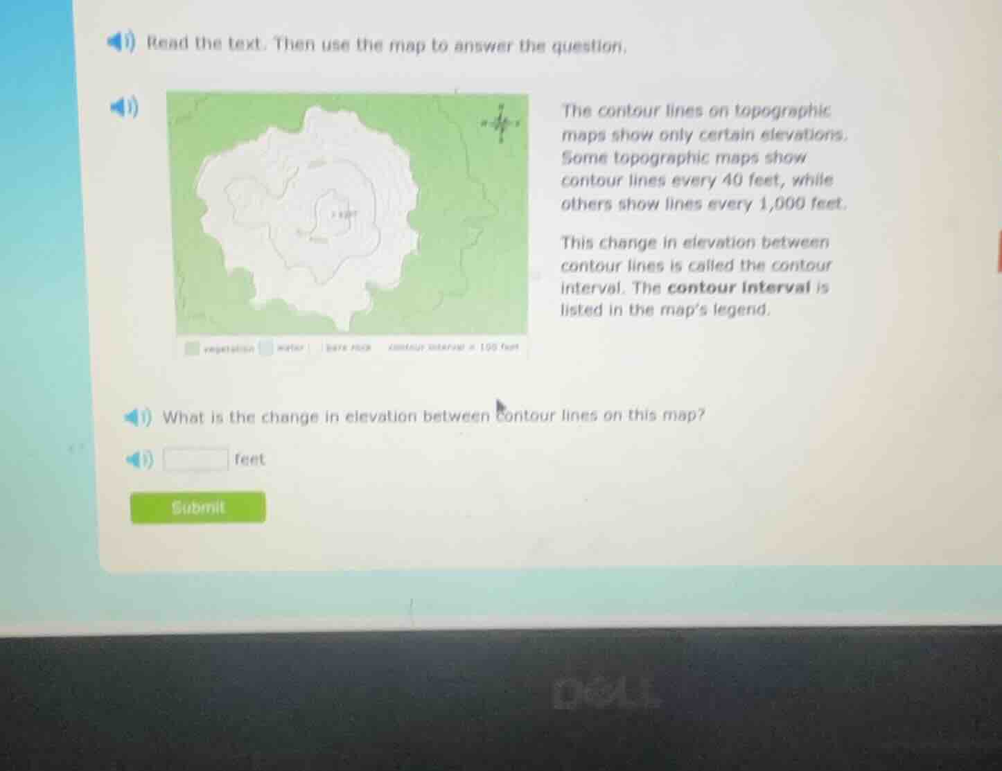
read the text. then use the map to answer the question.
the contour lines on topographic maps show only certain elevations. some topographic maps show contour lines every 40 feet, while others show lines every 1,000 feet.
this change in elevation between contour lines is called the contour interval. the contour interval is listed in the map’s legend.
what is the change in elevation between contour lines on this map?
____ feet
Step1: Analizar la leyenda del mapa
La leyenda del mapa indica "contour interval = 100 feet" (intervalo de contorno = 100 pies).
Step2: Determinar el cambio de elevación
El cambio de elevación entre líneas de contorno es el intervalo de contorno, que según la leyenda es 100 pies.

Snap & solve any problem in the app
Get step-by-step solutions on Sovi AI
Photo-based solutions with guided steps
Explore more problems and detailed explanations
100