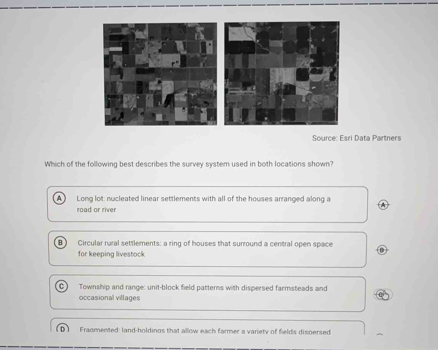
QUESTION IMAGE
Question
source: esri data partners
which of the following best describes the survey system used in both locations shown?
a long lot: nucleated linear settlements with all of the houses arranged along a road or river
b circular rural settlements: a ring of houses that surround a central open space for keeping livestock
c township and range: unit-block field patterns with dispersed farmsteads and occasional villages
d fragmented: land-holdings that allow each farmer a variety of fields dispersed
The images show uniform, square/rectangular unit-block field patterns, which match the township and range survey system. This system creates a grid-like land division with dispersed farmsteads, unlike the linear, circular, or fragmented patterns described in the other options.

Snap & solve any problem in the app
Get step-by-step solutions on Sovi AI
Photo-based solutions with guided steps
Explore more problems and detailed explanations
C. Township and range: unit-block field patterns with dispersed farmsteads and occasional villages