QUESTION IMAGE
Question
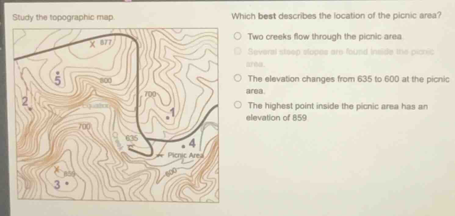
study the topographic map.
which best describes the location of the picnic area?
two creeks flow through the picnic area.
several steep slopes are found inside the picnic area.
the elevation changes from 635 to 600 at the picnic area.
the highest point inside the picnic area has an elevation of 859
Brief Explanations
- Option 1: No creeks are marked within the picnic area boundary.
- Option 2: The picnic area has widely spaced contour lines, indicating gentle slopes, not steep ones.
- Option 3: The picnic area spans contours from 600 to 635, so elevation ranges from 600 to 635, not 635 to 600.
- Option 4: The marked point 859 is inside the picnic area, and no higher elevation points lie within its boundary.

Snap & solve any problem in the app
Get step-by-step solutions on Sovi AI
Photo-based solutions with guided steps
Explore more problems and detailed explanations
D. The highest point inside the picnic area has an elevation of 859