QUESTION IMAGE
Question
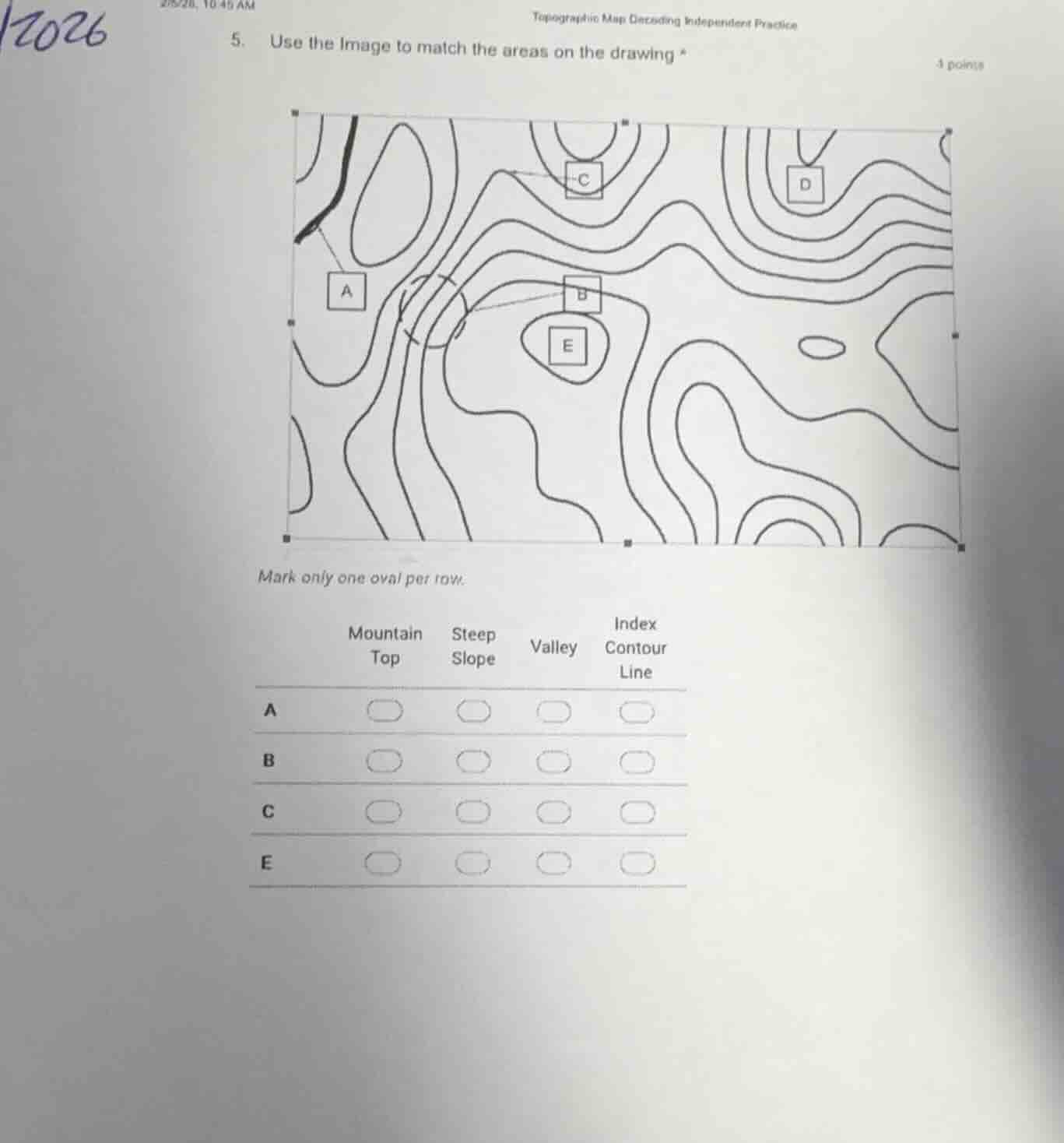
topographic map decoding independent practice
- use the image to match the areas on the drawing *
4 points
mark only one oval per row.
mountain top steep slope valley index contour line
a
b
c
e
Brief Explanations
- Area A: A V-shaped contour pattern pointing uphill indicates a valley, with the black line representing a stream in the valley.
- Area B: Closely spaced contour lines mean a steep slope, as closer lines show rapid elevation change.
- Area C: This is a bold, labeled contour line that serves as a reference for elevation, which is an index contour line.
- Area E: Closed, concentric contour lines with the smallest inner loop represent a raised landform, a mountain top.

Snap & solve any problem in the app
Get step-by-step solutions on Sovi AI
Photo-based solutions with guided steps
Explore more problems and detailed explanations
A. Valley
B. Steep Slope
C. Index Contour Line
E. Mountain Top