QUESTION IMAGE
Question
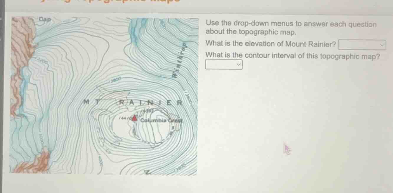
use the drop - down menus to answer each question about the topographic map. what is the elevation of mount rainier? what is the contour interval of this topographic map?
Step1: Identify peak elevation
The topographic map labels Mount Rainier's peak with the elevation value 14410 (or 14,410) feet.
Step2: Calculate contour interval
Find two labeled contour lines: e.g., 13000 and 14000. Count the spaces between them: there are 5 contour lines between (and including) them. Calculate interval: $\frac{14000 - 13000}{5} = 200$.

Snap & solve any problem in the app
Get step-by-step solutions on Sovi AI
Photo-based solutions with guided steps
Explore more problems and detailed explanations
What is the elevation of Mount Rainier? 14,410 feet
What is the contour interval of this topographic map? 200 feet