QUESTION IMAGE
Question
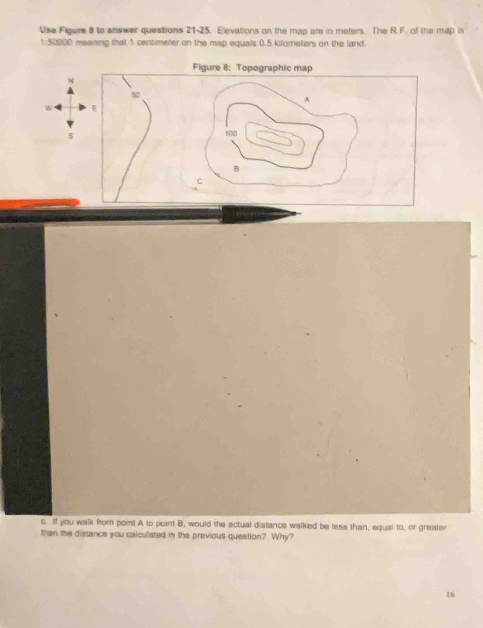
use figure 8 to answer questions 21-25. elevations on the map are in meters. the r.f. of the map is 1:50000 meaning that 1 centimeter on the map equals 0.5 kilometers on the land.
figure 8: topographic map
c. if you walk from point a to point b, would the actual distance walked be less than, equal to, or greater than the distance you calculated in the previous question? why?
Topographic maps show horizontal distance between points, but the actual walking distance over terrain with elevation changes (like from point A to B on a hill) follows the slope of the land, which is a longer path than the straight-line horizontal distance calculated from the map.

Snap & solve any problem in the app
Get step-by-step solutions on Sovi AI
Photo-based solutions with guided steps
Explore more problems and detailed explanations
The actual distance walked would be greater than the calculated map distance. This is because the map measures horizontal straight-line distance, while walking from A to B requires traveling up and over the sloped terrain of the hill, which adds length to the path.