QUESTION IMAGE
Question
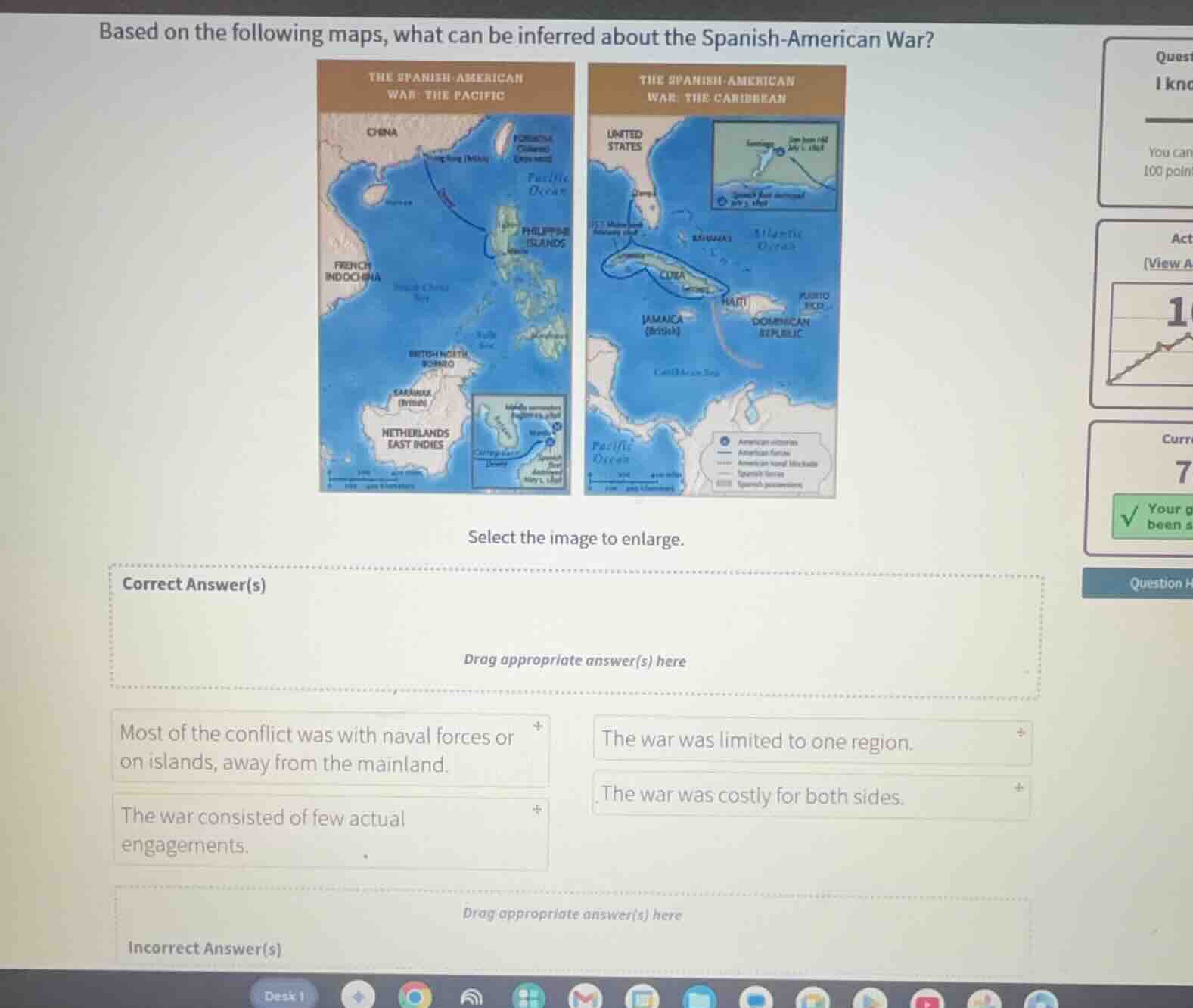
based on the following maps, what can be inferred about the spanish - american war?
the spanish - american
war: the pacific
the spanish - american
war: the caribbean
select the image to enlarge.
correct answer(s)
drag appropriate answer(s) here
most of the conflict was with naval forces or on islands, away from the mainland.
the war was limited to one region.
the war consisted of few actual engagements.
the war was costly for both sides.
incorrect answer(s)
drag appropriate answer(s) here
To determine the correct inference, analyze the maps:
- The Pacific map shows conflict near the Philippines (islands) and the Caribbean map shows conflict near Cuba/Puerto Rico (islands). Naval routes and engagements (e.g., naval blockades) are visible. So "Most of the conflict was with naval forces or on islands, away from the mainland" fits.
- "The war was limited to one region" is wrong (conflict in Pacific and Caribbean).
- "The war was costly for both sides" can’t be inferred from the maps (no cost data).
- "The war consisted of few actual engagements" also can’t be inferred from the maps (no info on number of engagements).

Snap & solve any problem in the app
Get step-by-step solutions on Sovi AI
Photo-based solutions with guided steps
Explore more problems and detailed explanations
Correct Answer(s): Most of the conflict was with naval forces or on islands, away from the mainland.
Incorrect Answer(s): The war was limited to one region, The war was costly for both sides, The war consisted of few actual engagements.