QUESTION IMAGE
Question
crq set 2 directions (32 - 34b): analyze the documents and answer the short - answer questions that follow each document in the space provided.
base your answer to question 32 on document 1 below and on your knowledge of social studies.
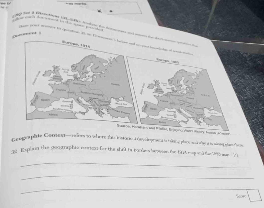
document 1
(there are two maps here, labeled europe, 1914 and europe, 1923)
source: abraham and pfeffer, enjoying world history, amsco (adapted)
geographic context—refers to where this historical development is taking place and why it is taking place there.
32 explain the geographic context for the shift in borders between the 1914 map and the 1923 map. 1
The border shift between 1914 and 1923 in Europe was due to World War I (1914 - 1918) and its aftermath, including the Treaty of Versailles. The war led to the collapse of empires like the German, Austro - Hungarian, and Russian (later became USSR) empires. The Treaty of Versailles redrew European borders: Germany lost territory, new nations like Czechoslovakia, Poland, etc., were created from the Austro - Hungarian and German/Russian empires. The geographic context is Europe, where the war was fought, and the political upheaval from the war and peace treaties led to these border changes as nations were redefined, ethnic groups sought self - determination, and defeated powers were forced to cede land.

Snap & solve any problem in the app
Get step-by-step solutions on Sovi AI
Photo-based solutions with guided steps
Explore more problems and detailed explanations
The border shift between the 1914 and 1923 European maps occurred due to World War I (1914 - 1918) and its aftermath (e.g., the Treaty of Versailles). WWI led to the collapse of the German, Austro - Hungarian, and Russian (later USSR) empires. In Europe (the geographic location of this development), the war’s outcome and peace treaties redrew borders: Germany lost territory, new nations (e.g., Czechoslovakia, Poland) formed from former empires, as ethnic self - determination and the defeat of imperial powers drove these changes.