QUESTION IMAGE
Question
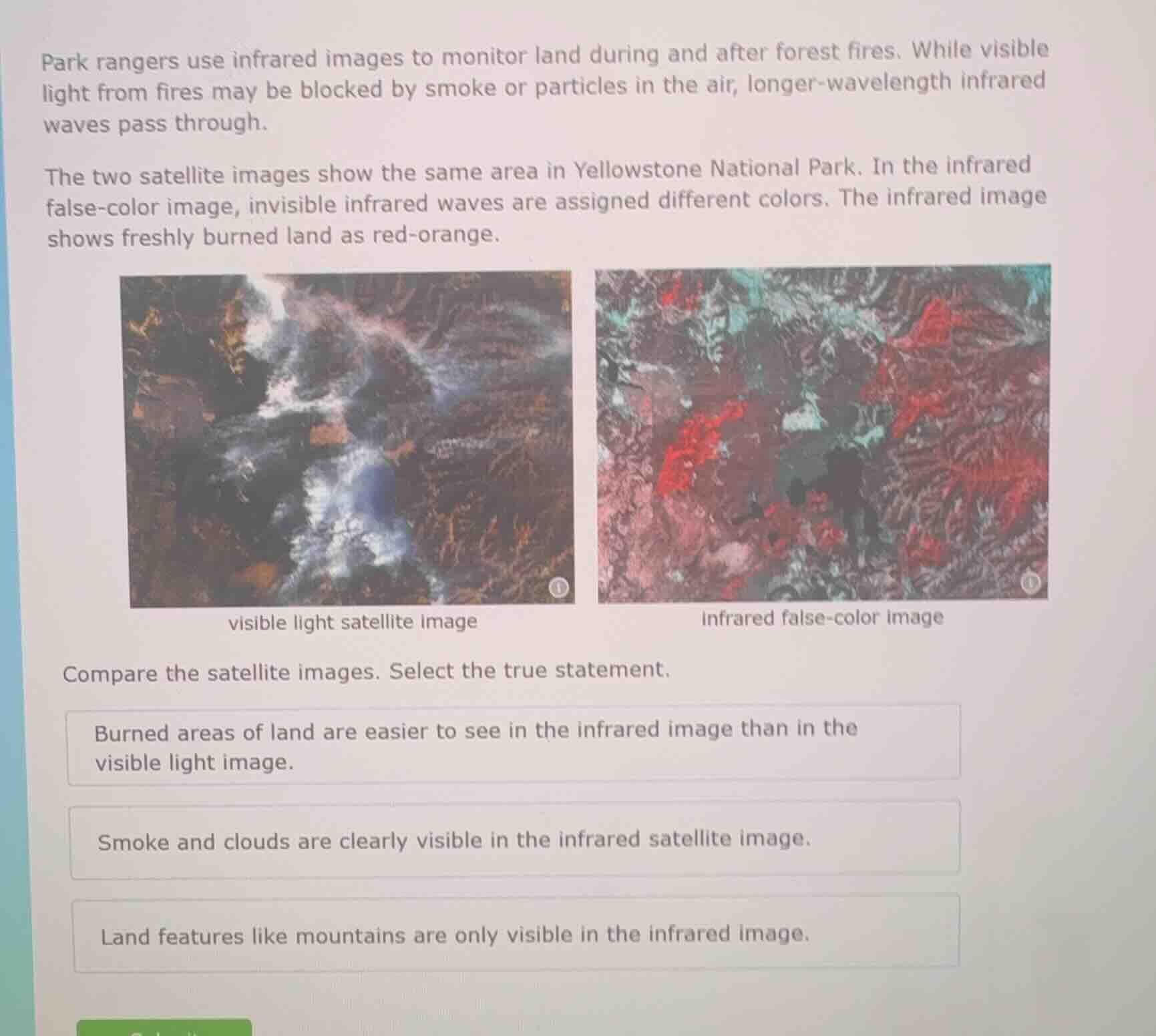
park rangers use infrared images to monitor land during and after forest fires. while visible light from fires may be blocked by smoke or particles in the air, longer-wavelength infrared waves pass through.
the two satellite images show the same area in yellowstone national park. in the infrared false-color image, invisible infrared waves are assigned different colors. the infrared image shows freshly burned land as red-orange.
visible light satellite image
infrared false-color image
compare the satellite images. select the true statement.
burned areas of land are easier to see in the infrared image than in the visible light image.
smoke and clouds are clearly visible in the infrared satellite image.
land features like mountains are only visible in the infrared image.
- For the first statement: The visible image is obscured by smoke/clouds, while the infrared image clearly marks burned land as red-orange, making burned areas easier to identify here.
- For the second statement: The text notes infrared waves pass through smoke/particles, so smoke/clouds are not clearly visible in the infrared image (they are visible in the visible light image).
- For the third statement: Land features like mountains are visible in both images, just represented differently.

Snap & solve any problem in the app
Get step-by-step solutions on Sovi AI
Photo-based solutions with guided steps
Explore more problems and detailed explanations
Burned areas of land are easier to see in the infrared image than in the visible light image.