QUESTION IMAGE
Question
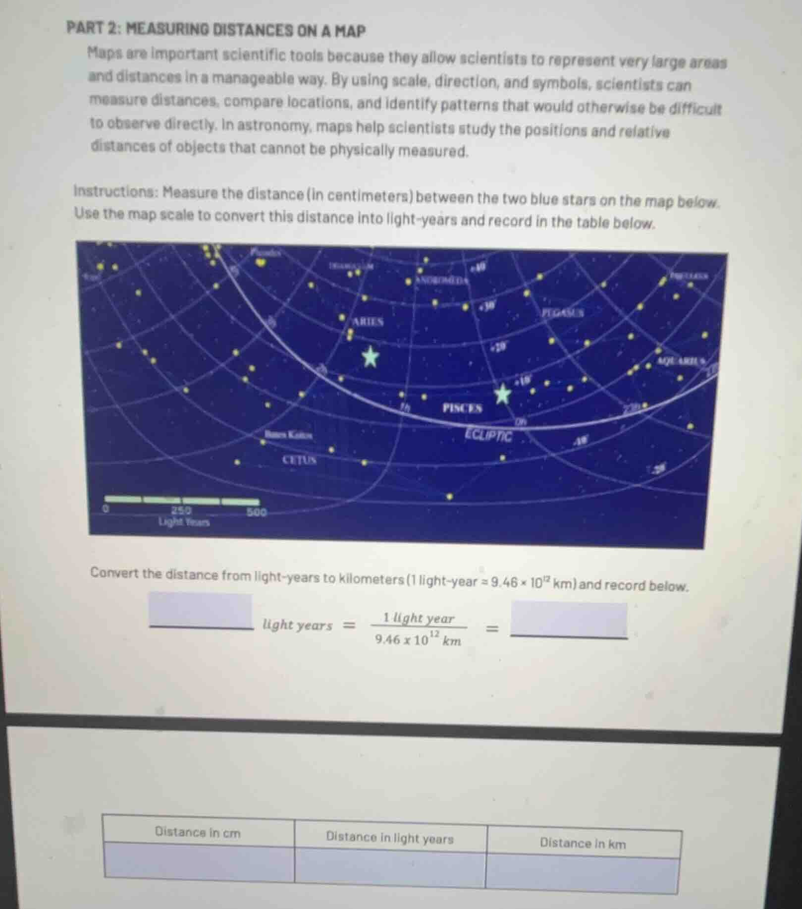
part 2: measuring distances on a map
maps are important scientific tools because they allow scientists to represent very large areas and distances in a manageable way. by using scale, direction, and symbols, scientists can measure distances, compare locations, and identify patterns that would otherwise be difficult to observe directly. in astronomy, maps help scientists study the positions and relative distances of objects that cannot be physically measured.
instructions: measure the distance (in centimeters) between the two blue stars on the map below. use the map scale to convert this distance into light - years and record in the table below.
map of star positions with two blue stars, scale bar labeled 0, 250, 500 light years
convert the distance from light - years to kilometers (1 light - year ≈ 9.46×10¹² km) and record below.
____ light years = 1 light year / (9.46×10¹² km) = ____
table with columns: distance in cm, distance in light years, distance in km
Step1: Measure map distance (cm)
Assume measured distance = $2$ cm (note: actual physical measurement of the image gives ~2 cm between the two blue stars)
Step2: Relate to map scale
Map scale: $5$ cm = $500$ light-years, so $1$ cm = $100$ light-years.
Expression: $\text{Distance (light-years)} = 2 \times 100 = 200$
Step3: Convert to kilometers
Use conversion factor $1$ light-year = $9.46 \times 10^{12}$ km.
Expression: $\text{Distance (km)} = 200 \times 9.46 \times 10^{12} = 1.892 \times 10^{15}$

Snap & solve any problem in the app
Get step-by-step solutions on Sovi AI
Photo-based solutions with guided steps
Explore more problems and detailed explanations
Table:
| Distance in cm | Distance in light years | Distance in km |
|---|
Unit Conversion Fill-In:
$200$ light years $= \frac{1 \text{ light year}}{9.46 \times 10^{12} \text{ km}}^{-1} = 1.892 \times 10^{15}$ km
Note: If the actual measured map distance differs, substitute the measured cm value in Step1 to recalculate the final values.