QUESTION IMAGE
Question
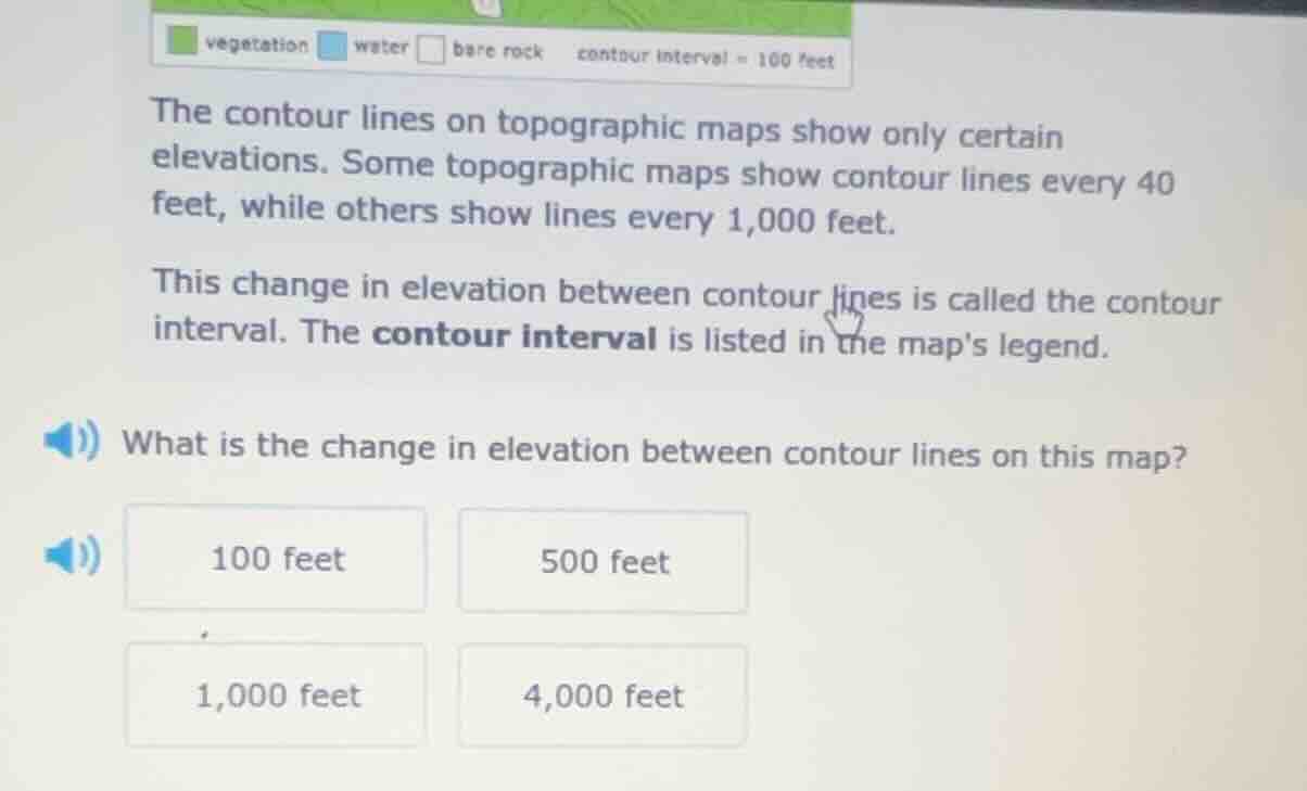
vegetation water bare rock contour interval = 100 feet the contour lines on topographic maps show only certain elevations. some topographic maps show contour lines every 40 feet, while others show lines every 1,000 feet. this change in elevation between contour lines is called the contour interval. the contour interval is listed in the maps legend. what is the change in elevation between contour lines on this map? 100 feet 500 feet 1,000 feet 4,000 feet
El problema trata sobre el intervalo de contorno en mapas topográficos. El texto indica que el intervalo de contorno se encuentra en la leyenda del mapa. En la parte superior de la imagen, la leyenda muestra "contour interval = 100 feet", por lo que el cambio de elevación entre líneas de contorno en este mapa es de 100 pies.

Snap & solve any problem in the app
Get step-by-step solutions on Sovi AI
Photo-based solutions with guided steps
Explore more problems and detailed explanations
A. 100 feet