QUESTION IMAGE
Question
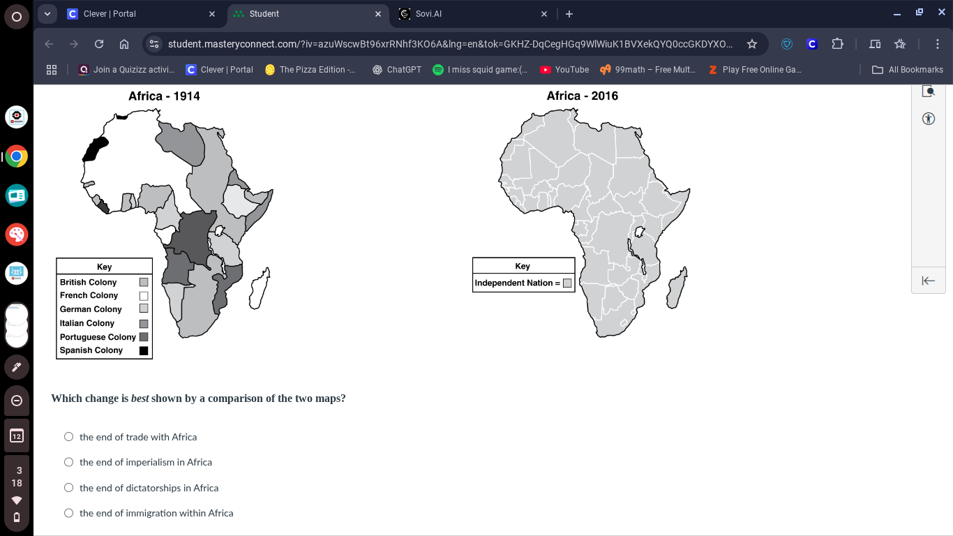
africa - 1914
africa - 2016
key
british colony $square$
french colony $square$
german colony $square$
italian colony $square$
portuguese colony $\blacksquare$
spanish colony $\blacksquare$
key
independent nation = $square$
which change is best shown by a comparison of the two maps?
○ the end of trade with africa
○ the end of imperialism in africa
○ the end of dictatorships in africa
○ the end of immigration within africa
The 1914 map shows Africa divided into European colonial territories (British, French, German, etc.). The 2016 map shows all African territories labeled as independent nations. This shift from colonial rule to self-governance reflects the end of formal imperial control over the continent. The other options are incorrect: trade with Africa continued, dictatorships persisted in some areas, and immigration within Africa did not end.

Snap & solve any problem in the app
Get step-by-step solutions on Sovi AI
Photo-based solutions with guided steps
Explore more problems and detailed explanations
the end of imperialism in Africa