QUESTION IMAGE
Question
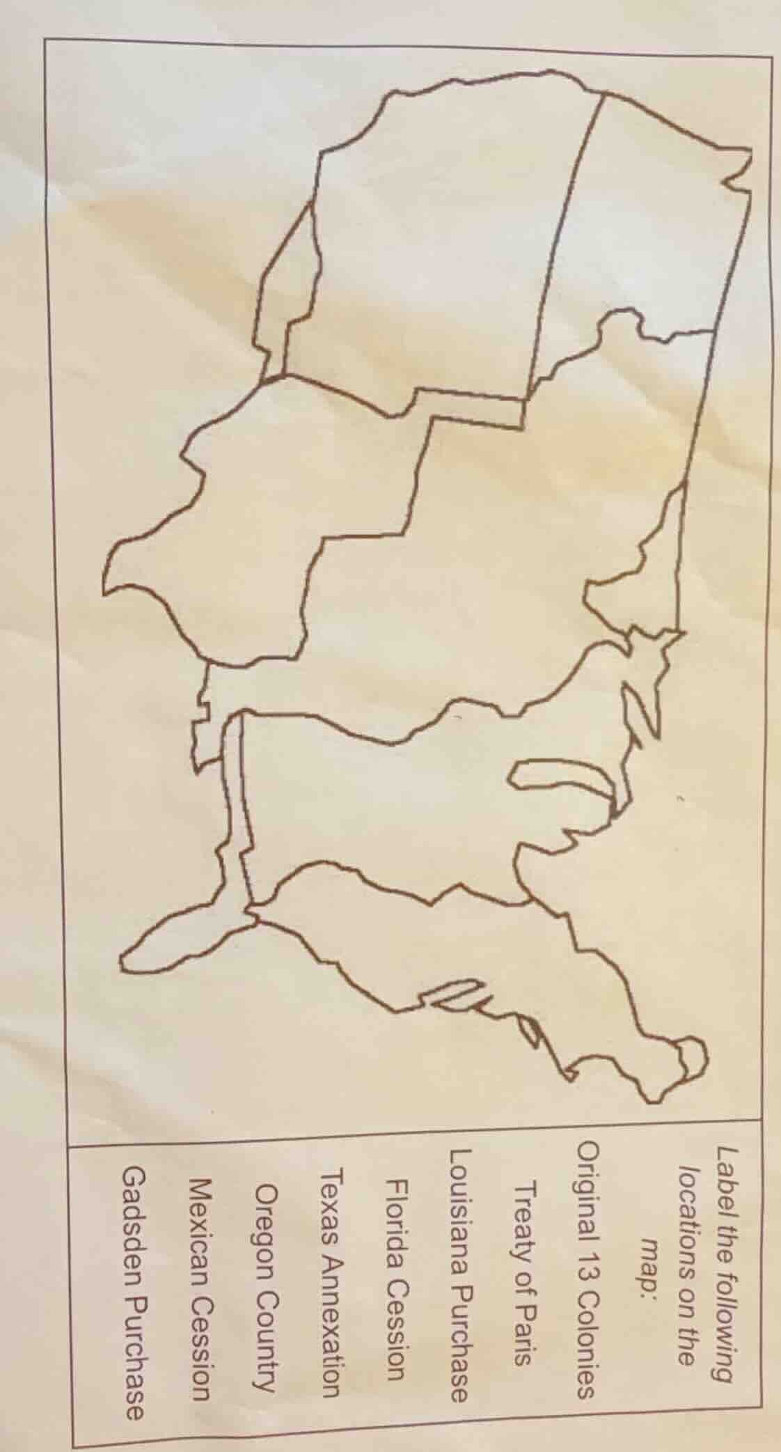
label the following locations on the map: original 13 colonies, treaty of paris, louisiana purchase, florida cession, texas annexation, oregon country, mexican cession, gadsden purchase
Brief Explanations
To label the map, we match each territorial acquisition to its region:
- Original 13 Colonies: East coast (smallest, easternmost region).
- Treaty of Paris: Northeast (after Revolutionary War, includes areas north/east of Ohio River).
- Louisiana Purchase: Large central region (stretches from Mississippi to Rockies).
- Florida Cession: Southeast (peninsula + northern Florida).
- Texas Annexation: Southwest (large southern region, includes Texas).
- Oregon Country: Northwest (Pacific Northwest, Oregon/Washington area).
- Mexican Cession: Southwest (California, Nevada, Utah, etc., after Mexican - American War).
- Gadsden Purchase: Southernmost (small strip in Arizona/New Mexico for railroads).

Snap & solve any problem in the app
Get step-by-step solutions on Sovi AI
Photo-based solutions with guided steps
Explore more problems and detailed explanations
- Original 13 Colonies: Eastern coastal region (smallest, near the Atlantic).
- Treaty of Paris: Northeast region (adjacent to Original 13, north - east).
- Louisiana Purchase: Large central region (covers most of the middle of the map).
- Florida Cession: Southeast (peninsula - shaped area in the south - east).
- Texas Annexation: Southwest (large southern region, including Texas - shaped area).
- Oregon Country: Northwest (the north - west region of the map).
- Mexican Cession: Southwest (the south - west region, larger than Gadsden Purchase, includes California - like area).
- Gadsden Purchase: Southernmost (small strip in the very south - west, below Mexican Cession).