QUESTION IMAGE
Question
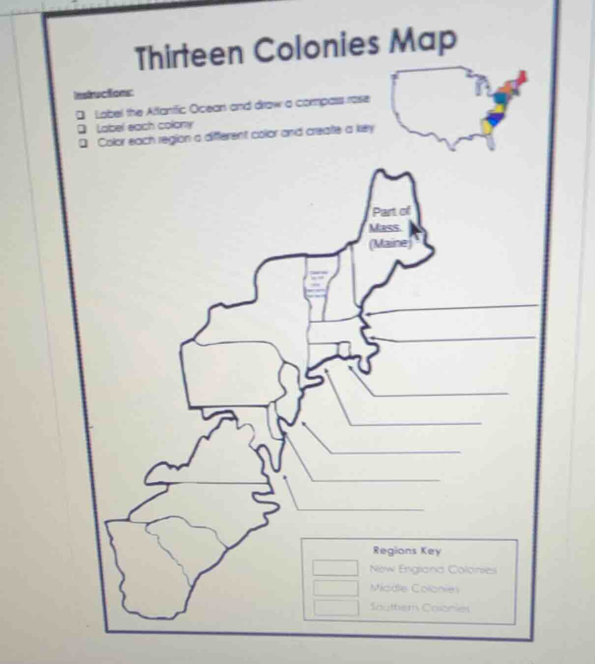
thirteen colonies map
instructions:
- label the atlantic ocean and draw a compass rose
- label each colony
- color each region a different color and create a key
(there is a map of the thirteen colonies with some labeled parts like part of mass (maine) and a regions key for new england colonies, middle colonies, southern colonies)
Brief Explanations
- The 13 colonies are grouped into their standard regional categories: New England (northernmost), Middle (mid-Atlantic), and Southern (southernmost).
- The Atlantic Ocean is located to the east of all 13 colonies, as they were established along the U.S. East Coast.
- A standard compass rose provides directional context for the map, placed in an unobstructed corner.
- A distinct color is assigned to each regional group to meet the "color each region a different color" instruction, with a key linking color to region.

Snap & solve any problem in the app
Get step-by-step solutions on Sovi AI
Photo-based solutions with guided steps
Explore more problems and detailed explanations
- Labeled Colonies (from north to south):
- New England Colonies: Maine (Part of Mass.), Massachusetts, New Hampshire, Rhode Island, Connecticut
- Middle Colonies: New York, Pennsylvania, New Jersey, Delaware
- Southern Colonies: Maryland, Virginia, North Carolina, South Carolina, Georgia
- Labeled Feature: Atlantic Ocean (east of all colonies)
- Compass Rose: Drawn in a corner (e.g., top right) with labels: North (N), East (E), South (S), West (W)
- Color Key:
- New England Colonies: Blue
- Middle Colonies: Green
- Southern Colonies: Yellow