QUESTION IMAGE
Question
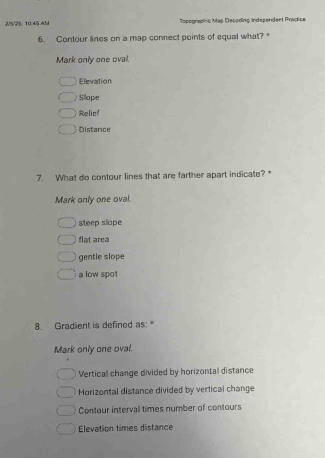
2/5/26, 10:45 am
topographic map decoding independent practice
- contour lines on a map connect points of equal what? *
mark only one oval.
elevation
slope
relief
distance
- what do contour lines that are farther apart indicate? *
mark only one oval.
steep slope
flat area
gentle slope
a low spot
- gradient is defined as: *
mark only one oval.
vertical change divided by horizontal distance
horizontal distance divided by vertical change
contour interval times number of contours
elevation times distance
Brief Explanations
- For question 6: Contour lines are a core feature of topographic maps, specifically designed to link points that share the same vertical height above a reference point.
- For question 7: The spacing of contour lines relates to slope steepness; wider spacing means the elevation changes gradually over a horizontal distance.
- For question 8: Gradient (or slope) in topography is calculated as the ratio of the vertical elevation change to the horizontal distance over which that change occurs.

Snap & solve any problem in the app
Get step-by-step solutions on Sovi AI
Photo-based solutions with guided steps
Explore more problems and detailed explanations
- A. Elevation
- C. gentle slope
- A. Vertical change divided by horizontal distance