QUESTION IMAGE
Question
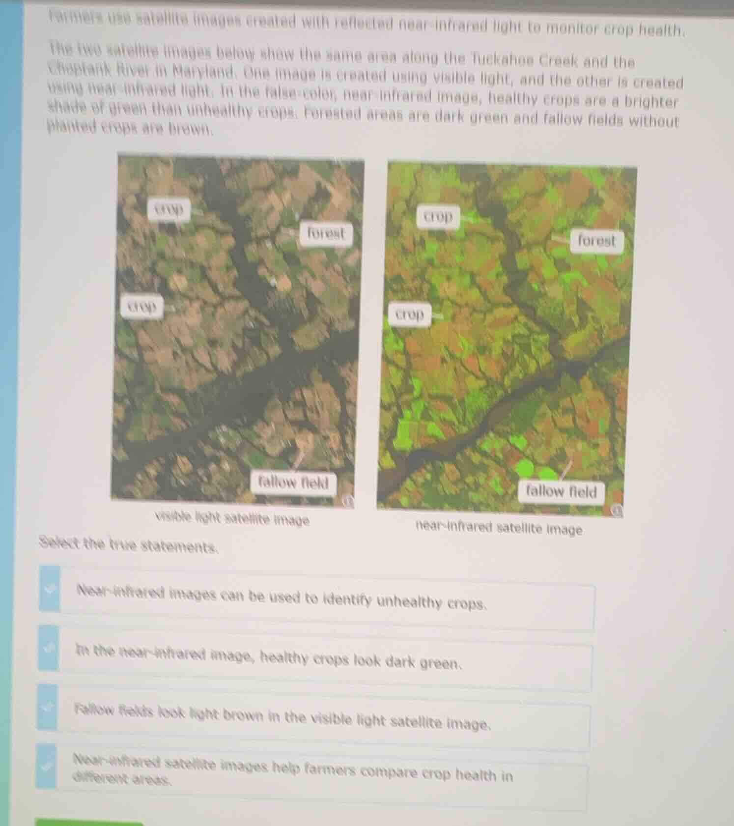
farmers use satellite images created with reflected near-infrared light to monitor crop health.the two satellite images below show the same area along the tuckahoe creek and thechoptank river in maryland. one image is created using visible light, and the other is createdusing near-infrared light. in the false-color, near-infrared image, healthy crops are a brightershade of green than unhealthy crops. forested areas are dark green and fallow fields withoutplanted crops are brown.visible light satellite imagenear-infrared satellite imageselect the true statements.near-infrared images can be used to identify unhealthy crops.in the near-infrared image, healthy crops look dark green.fallow fields look light brown in the visible light satellite image.near-infrared satellite images help farmers compare crop health in different areas.
- Near-infrared images distinguish healthy (bright green) and unhealthy crops, so they can identify unhealthy crops.
- The text states healthy crops are bright green (not dark green) in near-infrared images, so this is false.
- The visible light image shows fallow fields as light brown, matching this statement.
- By showing crop health differences via color, near-infrared images let farmers compare crop health across areas.

Snap & solve any problem in the app
Get step-by-step solutions on Sovi AI
Photo-based solutions with guided steps
Explore more problems and detailed explanations
- Near-infrared images can be used to identify unhealthy crops.
- Fallow fields look light brown in the visible light satellite image.
- Near-infrared satellite images help farmers compare crop health in different areas.