QUESTION IMAGE
Question
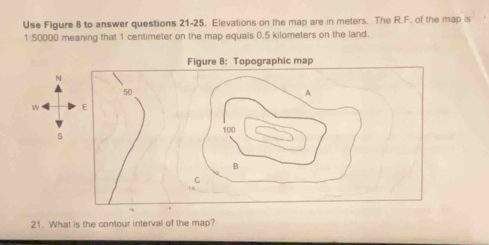
use figure 8 to answer questions 21-25. elevations on the map are in meters. the r.f. of the map is 1:50000 meaning that 1 centimeter on the map equals 0.5 kilometers on the land. figure 8: topographic map 21. what is the contour interval of the map?
Step1: Identify labeled contour lines
Locate the marked elevations: 50 m and 100 m.
Step2: Count contour lines between them
There is 1 full contour line between the 50 m and 100 m lines, so the vertical distance between 50 m and 100 m spans 2 intervals.
Step3: Calculate contour interval
Divide elevation difference by interval count:
$\text{Contour Interval} = \frac{100 - 50}{2} = 25$ meters

Snap & solve any problem in the app
Get step-by-step solutions on Sovi AI
Photo-based solutions with guided steps
Explore more problems and detailed explanations
25 meters